From the BlogSubscribe Now

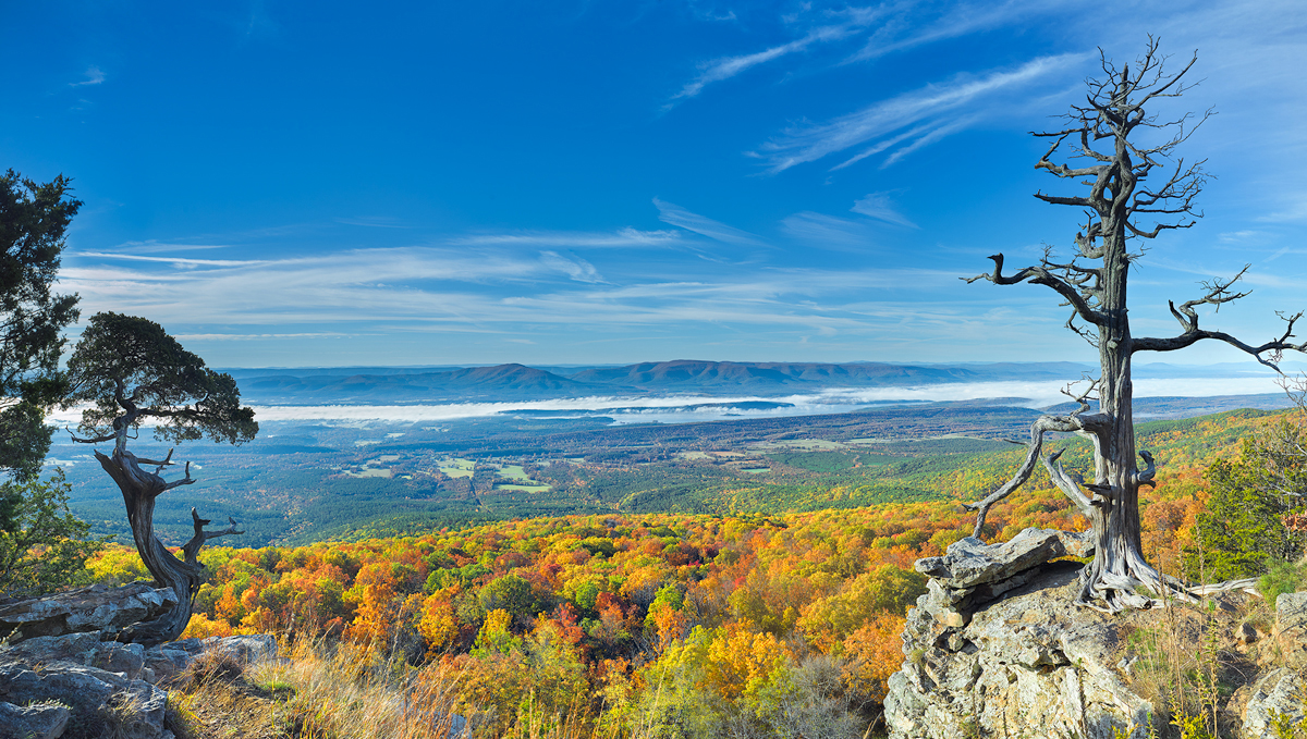
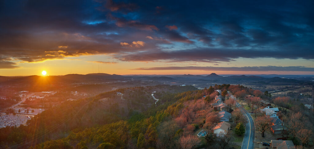
01/24/24 Sunset over Walton Heights and Pinnacle Valley

A wintertime sunset from Walton Heights in Little Rock featuring Pinnacle Mountain.
Wintertime sunset from Walton Heights in Little Rock overlooking Pinnacle Valley

There are times that the best view of a particular subject is from the air. With the use of a drone, I was able to capture this sunset in several separate images, then combine them into one single image. The dynamic range of the files is limited, so I chose to use exposure bracketing of 5 shots per image, then combining several of the single files to create one image.

The problem with a drone is that you have to be very careful when shooting into the sun as it’s very easy to totally blow out your highlights. This image was taken with a DJI Mavic 2 Pro, which has a 20MP sensor, but the sensor is nowhere near the same quality as a 35mm camera with 20MP or 24mp.

The other problem that can occur is drift, during the series of images. Even in a quick 5 shot bracket the drone can slightly drift and thus the file will not line up perfectly. If this occurs, then it’s best to use load the needed files into Photoshop, as layers, and then use the “align layers” feature. This will usually allow for a close enough alignment so you can proceed with the work.

Using a drone often gives a much better perspective overall and I always try to have a drone with me in the woods.
01/22/24 Looking through the Keyhole on Roark Bluff–Autumn

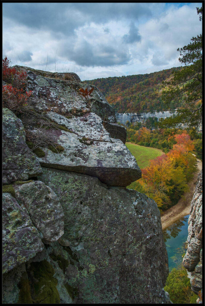
A view from the summit of Roark Bluff in Arkansas, featuring the keyhole.

One of my favorite locations in Arkansas is the Buffalo River which runs across the northern part of the state. It runs eastward eventually emptying into the White River, making it the largest tributary of the White.

I love to work the river, along it total length. Fall offers some wonderful color as various deciduous trees turn shades of yellow, red, and bright orange.

This particular spot is what I call the keyhole and is on the top of Roark Bluff. Roark bluff is one of the single largest bluffs on the river and is near the town of Ponca. You can get to the base of the bluff by stopping by the Steel Creek landing. Directly below Roark is Bee Bluff, which can offer a wonderful view at sunset in the fall.

I took this shot with a Fuji X-T2, in a series of bracketed exposures to combine later as a single image. From this view you can see the upper end of Roark Bluff as it winds around to the left and in the lower part of the image you can see the Buffalo River and the row of Maple and Gum trees that line the river bank on the left side.

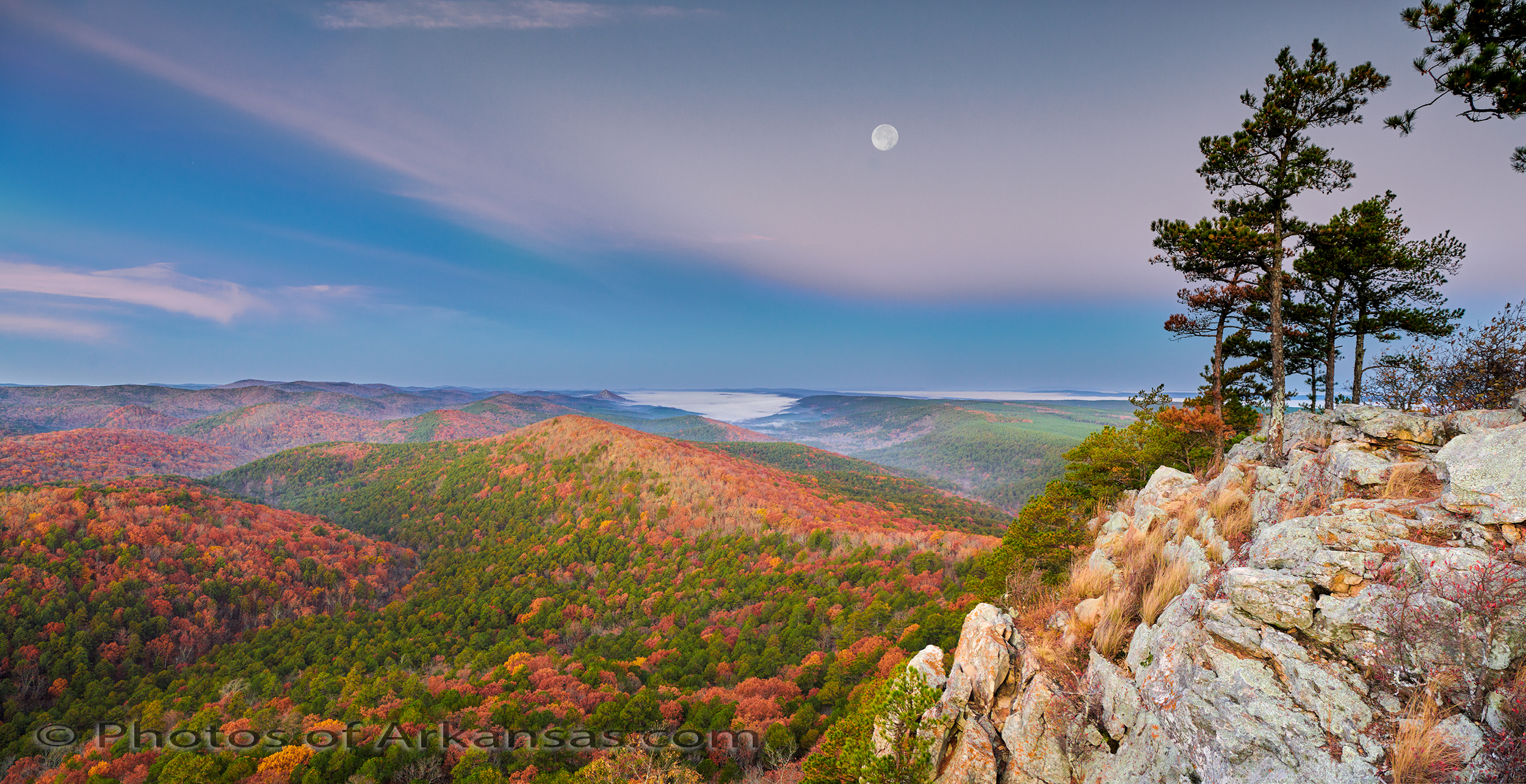
Dawn Light and Full Moon from Summit of Flatside Pinnacle–11/29/18 Featured Arkansas Photography

Flatside Pinnacle Images of Arkansas

Dawn light from the Summit of Flatside Pinnacle

Nikon D850 & 24-70 Lens, ISO 800 and bracketing 3 stops, 2 frames 6 exposures total

Arkansas abounds with scenic wonder and one of the best spots to catch a fall dawn is from the wind swept summit of Flatside Pinnacle.  The hike is a short .2 miles from where you park, to the summit.  All up hill and you will gain about 150 feet in those .2 miles.  The last 20 yards of the trail is the steepest pitch and is more treacherous descending than climbing since it’s all sloping rock which tend to be quite slick.  The great thing about Flatside is the view.  You basically have a 360 degree view of all the surrounding terrain.  Looking back towards the east you can see Pinnacle Mountain and Lake Mamuelle (on a clear day) and to the west Forked mountain (which is the peak out to west in this shot) then to the north, Petit Jean, Spring, Mt Nebo and Mt Magazine all line up.  What a view.

Flatside’s summit is almost always windy, it was the morning this shot was taken.  Expect winds of over 10 mph standard and gusts that can approach 20 mph.

In the fall, the sun will rise off to the left and when it starts to pop over the horizon, the light that lasts for about 5 minutes is amazing.  It’s a muted looks but adds a lot of overall saturation to the scene.  You can also turn directly around and catch a great sunrise, but that shot takes practice as odds are there will be wind blowing to cause the need for faster shutter speeds.

On this day there was fog in every surrounding valley besides Flatside, and I had hoped for a bit more.  The only fog I had was way out by Forked Mountain and beyond.  But during the early morning hours the fog did advance a bit.  Looking behind me the entire view to the east was all fog, and the summit of Nebo, Mt. Magazine and Petit Jean (Stouts Point) all stood out over the fog.  Great scene.

For this shot, I took 6 frames in two different positions knowing I would stitch the 2 frames together later into a short panorama.  There was very low light overall and about 10 mph wind blowing as can be seen by the grass in the foreground.  Knowing that the D850 has a dynamic range boost from ISO 800 up, I jumped right to ISO 800 for the shots.  I still was keep in a pretty slow exposure range due to the aperture I wanted, F8.  The resulting files were cleaner than I expected.  I used Capture One to convert the raws, and Photoshop to stitch.  The moon was troublesome as to capture it’s exposure correctly meant that I had to totally under expose the rest of the scene.  So I took a series of separate shots of the moon then pulled them back into the shot with corrected exposure.  Just makes the work a bit easier.

Flatside is well worth the 1 hour drive from Little Rock.


Written for www.photosofarkansas.com by Paul Caldwell 11/28/18.  Please contact me before anything in this post is used for either reprinting or printing. 


08/16/16 A few notes on the Dynamic Range of the Phase One IQ100

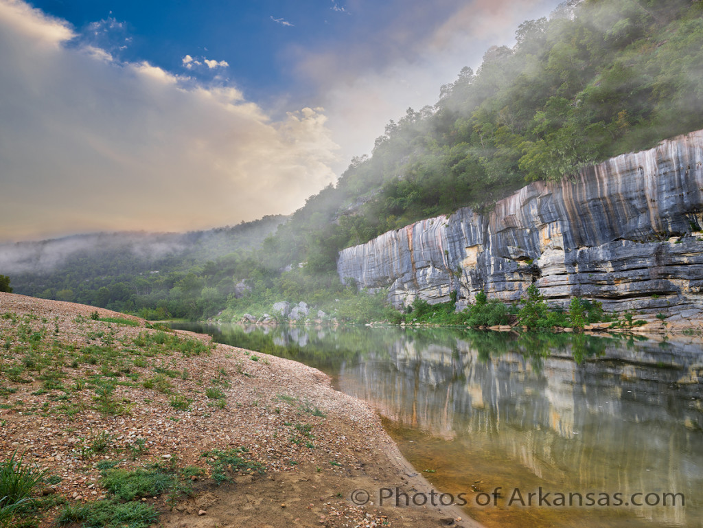
Early mornings are some of the best times to photograph the Buffalo River.  This is from Buffalo Point.

Early mornings are some of the best times to photograph the Buffalo River. This is from Buffalo Point.

I am starting to get a better feel for the Phase One IQ100 and just where the dynamic range of this amazing digital back performs.  You can read a lot more this in a new article I just published over on photosofarkansas.  This article covers some discoveries I have made in regards to handling both shadow details and recovery of highlights.  You can read more about it here.

06/11/13 The Cut on Forest Road 1205 in Searcy and Newton Counties of Arkansas

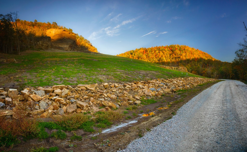
The cut along Forest Road 1205 in Newton County, Arkansas

The cut along Forest Road 1205 in Newton County, Arkansas

Image was taken with a Sony Nex-7, Sony 16-80mm Zoom Zeiss lens @ 16mm (effective 24mm on Nex7), iso 200.  This is a composite image taken in 3 vertical segments then stitched together in Photoshop CS6 to get the final image.  Raw files were converted using Lightroom 4.1

If you have traveled the back roads of Arkansas much, you will have driven on forest road 1205.  This single road passes some of the most impressive scenery in the state.  1205 runs pretty much north and south and for about half of it’s length it parallels Falling Water Creek.  Falling Water Creek has some very impressive features including Falling Water Falls, which is a ledge drop that covers the entire width of the creek and is about 13 feet high.  1205 follows along Falling Water Creek, and then crosses over Richland creek, which is one of the best places to hike, camp and photograph in Arkansas.  From the crossing of Richland, 1205 begins a long climb up the adjoining ridges and then tops out about 1000 feet higher at Dicky Junction.  1205 can be driven in a car, but there are places where it might be a bit tough as the road has started to really fall apart here it enters Newton County.   There are many people who live along 1205 and it’s a road that is important as a U.S. mail connection.

Many people won’t remember back to March of 2008, but during this time in Arkansas there were several really heavy rains that fell in close succession to each other.  The first one of these rains started a minor slide in a weak hillside along 1205.  This spot was about 2 miles south from the Richland Creek Campground.  The slide was minor and with some bulldozer work most of it was cleared up.  In the next few weeks, more heavy rainfall caused a further weakening and eventually the entire mountainside slumped away.  The damage was tremendous and for about 1/16th of a mile where 1205 had been was only a mass jumble of downed trees and huge rocks.  Several times I attempted to hike through to the other side, but the damage was such that you really could not make much progress before coming to a huge tree or rock which required a long detour.

The plan was to have the U.S. Forest service repair the road and do a repair that would last.  In the interim, Richland Creek campground was closed and one of the most vital links for transportation was no longer there.  For about the next 2 years, not too much was done.  Many people complained about the campground being closed, but the Forest Service felt that they could not get access to this area fast enough if there was an emergency.   Traffic was routed back around the upper end of 1205 if you wanted to get to Richland.

[Read more…]