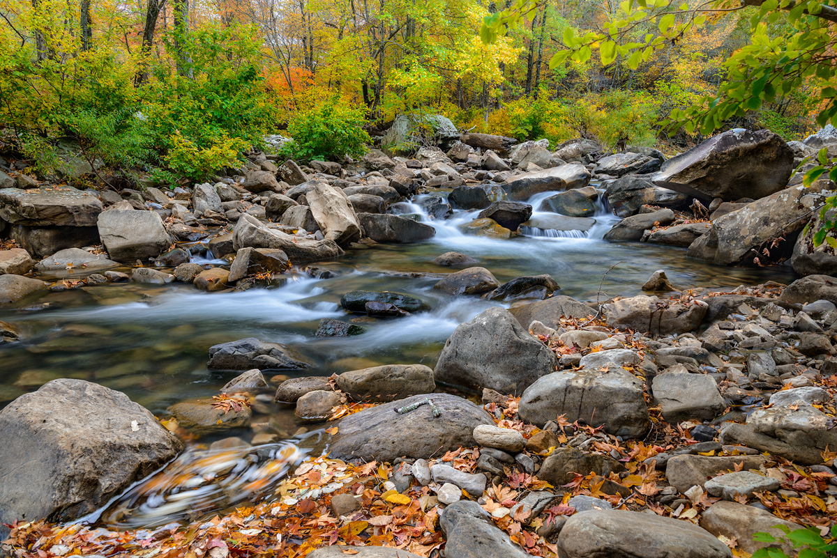
Arkansas has many famous spots for outdoor recreation which feature lakes, or streams. For sure one of the best is Richland creek, in the northwest part of Arkansas. With Richland Creek one can find a stream that is the 2nd largest tributary of the Buffalo river which has a huge watershed that cross through several Arkansas counties before emptying into the Buffalo river at Woolum. In the winter and springtime Richland is famous for kayaking both the upper and lower portions of the creek. During the late spring and summer Richland tends to offer a quiet and tranquil location to get away from busier parts of Arkansas. During the autumn, Richland can offer one of the most dramatic displays of fall color in the state since there are several areas along the creek that have trees approaching 50 to 70 years of age. I like to try and hike Richland at least 4 times during the year to catch the creek at it’s different stages each of which can offer amazing photograhic opportunities.
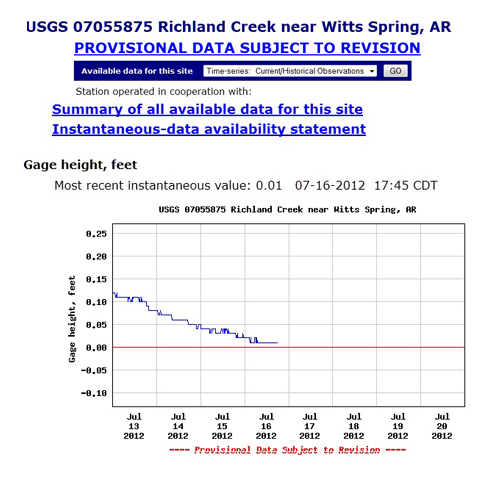
On my weekly checks of Richland Creek’s USGS Hydro-graph I have watched as my favorite creek has slowly dropped down the chart. However today when I checked the creek, I was amazed to see a flat-line 0.00. I have never in 18 years of monitoring Richland seen it this low. The gauge is near the concrete bridge immediately below the campground and I have to assume that the large pool at the bridge is now dry or very close to being dry. Richland’s being this low really puts into perspective just how low the state of Arkansas’s wild stream flow is currently. I also check the Buffalo River and it is now showing 0.25 at the Boxley gauge which is also very low, even for this time of the year.


Recent Comments