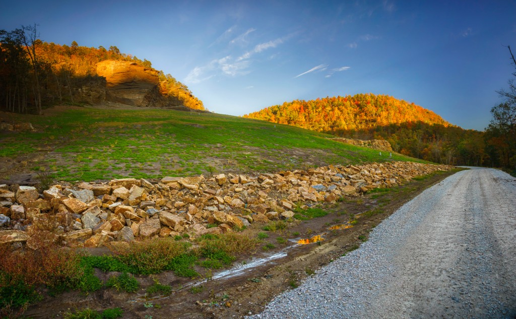
Image was taken with a Sony Nex-7, Sony 16-80mm Zoom Zeiss lens @ 16mm (effective 24mm on Nex7), iso 200. This is a composite image taken in 3 vertical segments then stitched together in Photoshop CS6 to get the final image. Raw files were converted using Lightroom 4.1
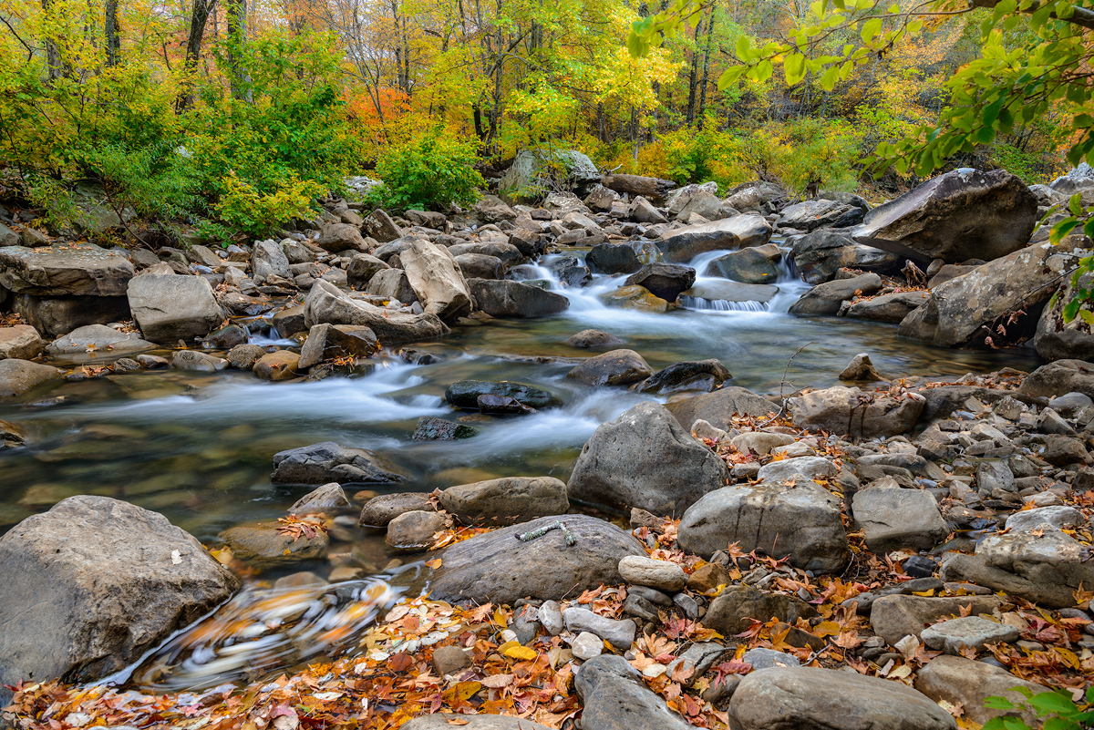
If you have traveled the back roads of Arkansas much, you will have driven on forest road 1205. This single road passes some of the most impressive scenery in the state. 1205 runs pretty much north and south and for about half of it’s length it parallels Falling Water Creek. Falling Water Creek has some very impressive features including Falling Water Falls, which is a ledge drop that covers the entire width of the creek and is about 13 feet high. 1205 follows along Falling Water Creek, and then crosses over Richland creek, which is one of the best places to hike, camp and photograph in Arkansas. From the crossing of Richland, 1205 begins a long climb up the adjoining ridges and then tops out about 1000 feet higher at Dicky Junction. 1205 can be driven in a car, but there are places where it might be a bit tough as the road has started to really fall apart here it enters Newton County. There are many people who live along 1205 and it’s a road that is important as a U.S. mail connection.
Many people won’t remember back to March of 2008, but during this time in Arkansas there were several really heavy rains that fell in close succession to each other. The first one of these rains started a minor slide in a weak hillside along 1205. This spot was about 2 miles south from the Richland Creek Campground. The slide was minor and with some bulldozer work most of it was cleared up. In the next few weeks, more heavy rainfall caused a further weakening and eventually the entire mountainside slumped away. The damage was tremendous and for about 1/16th of a mile where 1205 had been was only a mass jumble of downed trees and huge rocks. Several times I attempted to hike through to the other side, but the damage was such that you really could not make much progress before coming to a huge tree or rock which required a long detour.
The plan was to have the U.S. Forest service repair the road and do a repair that would last. In the interim, Richland Creek campground was closed and one of the most vital links for transportation was no longer there. For about the next 2 years, not too much was done. Many people complained about the campground being closed, but the Forest Service felt that they could not get access to this area fast enough if there was an emergency. Traffic was routed back around the upper end of 1205 if you wanted to get to Richland.
In the spring of 2011 work started on the repair. I noticed some signs there were up closing parts of 1205. I had planned to drive over to one of the features on Falling Water Creek, but came upon the road closed signs. During 2011 and most of 2012 the work continued. I ran into one of the contractors one day on the road and they told me that at least 500,000 cubic yards of earth was being moved over to fix the road. This did not include the huge number of trees that had to be moved, or burned and rocks. On that day and several others when I ventured up to Falling Water Creek, I found that the trucks were running pretty much around the clock and they were really running. The signs were not kidding about don’t drive on the road, as these trucks were running by radio command and were not expecting to find a wayward car on the road. There were a few signs that a few more ignorant folks ignored this and drove on down past the warnings, evidenced by several sharp tracks turning off into the woods to avoid a head-on with a dump truck. During all of the time, I never drove up to the slide, since the road was close from the south and the drive in from the north end would have been very tedious.
In late 2011 the work was finished and a note went out stating that the road up to the slide area was now open. I kept on coming to Richland the old way up and around from Dicky Junction but finally made my way over to the new work in October of 2012.
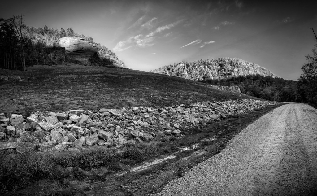
All I can say is that it was a lot more work than I had ever considered. The “cut” is huge and goes back along the ridge as far as the eye can see to the east. The slope off is very gradual and runs all the way to the solid rocks that make up the upper head wall of the Canyon. In the shot I have posted you are looking at the cut from the northern edge. They road runs along the base of the cut pretty much in a straight line only curving up at the southern most end. All along the exposed face are small silver boxes and I assume these are slide meters to see if the mass of earth is still moving. At the southern most end of the cut along the road where a small creek cuts in, you can see just a bit of slippage. This entire project looks like something out of West Virginia instead of Arkansas and would definitely rival the cuts made during the creation of I-540. It’s a very impressive site, just standing at the base of the cut and looking back towards the eastern edge. I you decided to hike into the back it would take well over 1 hour to get there and back.
For folks interested in geology, this is one place to come and visit. You can see all of the various layers of strata that were cut out to get down to the base ground. The rock faces along the tops of the cliffs look like sandstone but I am not totally sure what rock they are. You can see tons of faults, cracks and slides starting all along the faces so the rock is not very stable in nature. The work that was done looks very good, and I like the fact that grass was planted in the scour area below the face faces to help hold the rest of the face in place. I have not driven over to the cut since the last 2 big rain events, the 1st of which brought Richland Creek up to at least 9000 CFS in less than 2 hours. 9000 CFS on Richland is a LOT of water going through a very narrow valley in a hurry! In 2008 Richland came up to 20,000 CFS during one of the huge rain events that caused the eventual slide along 1205.
If you are familiar with this part of the state, make it a point to drive up and stop to take in the cut along 1205. If you have never been up to Richland, make sure you plan your trip to include forest road 1205 so you can see this most impressive piece of construction. Hopefully it will last a while.
Recent Comments