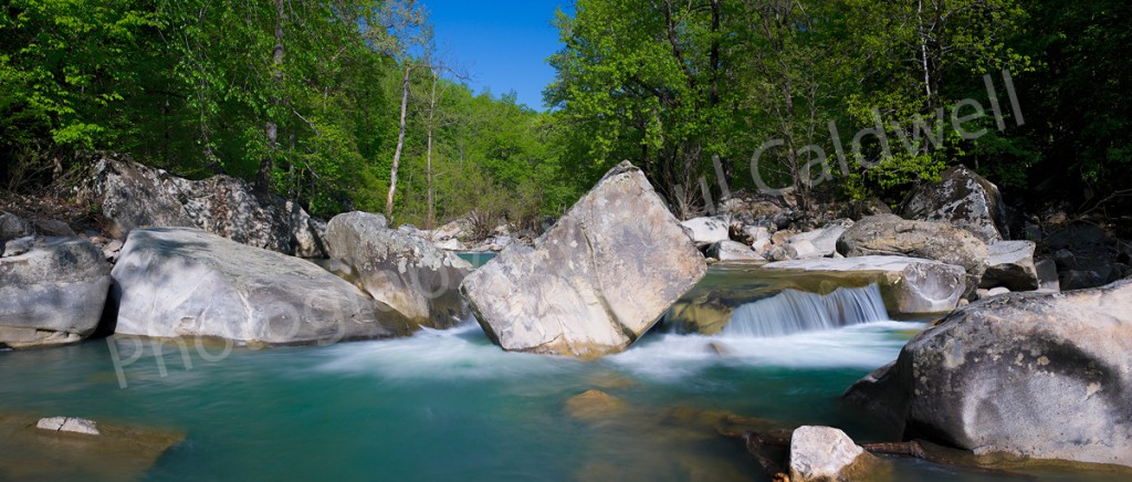
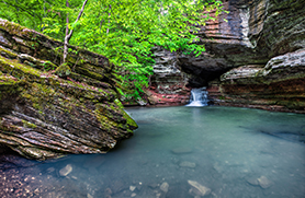
This is a view of Richland Creek in late May, taken in the 2007 time frame, but I wanted to use this photograph to show just what Richland Creek should look like now, in July!!. Normally this time of year, the water levels in the Arkansas creeks is very low, to almost dry. Richland will run a bit of water in the summer months, but not anywhere enough to make it worth a trip up the creek. All that normally is available will the pools below each of the drops, like the one in this picture.
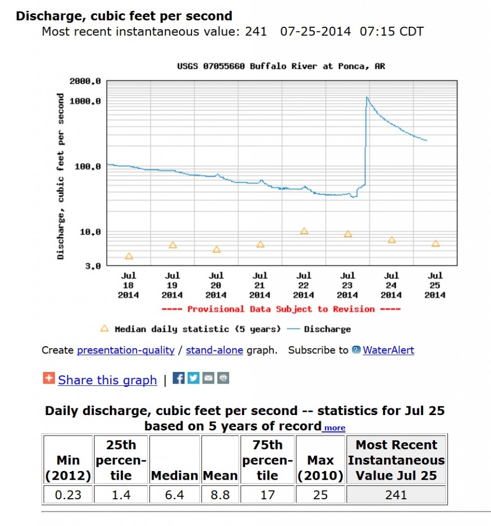
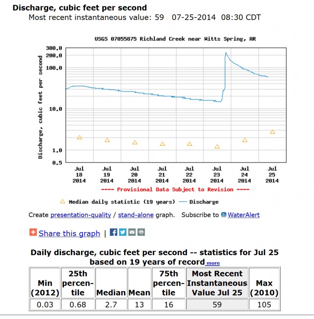
However in 2014, Arkansas has had a series of large rains, all of which hit the Ozarks. Just 2 days ago, the Buffalo River, near Ponca was running at over 1000 CFS, which for the Buffalo in July is unheard of. Richland was running in the 250 CFS range.
As you can see in the graph above, the Buffalo was as high as 1000 CFS and is still in the 241 CFS range 2 days out from the rain. This means that you could canoe the entire river from Highway 21 all the way to the mouth of the Buffalo where it runs into the White river. But what is even more significant is look back 7 days and you can see that the Buffalo was holding in the 100 CFS range which is even more impressive. Normally this time of year, you could expect to see around 15 CFS or less. This is great news for the local canoe outfitters along the entire river as they can continue to rent boats into July.
This graph shows the water levels for Richland Creek, which shows it did not hold to the 100 CFS range of the Buffalo but was still at 28 or so CFS before the last big rain. Again, this is pretty impressive for a creek the size of Richland.
This means that if you like to hike the Arkansas Outdoors, July is a great time to get out. Richland is not an easy hike in July as the undergrowth of the forest will make for a pretty hard hike. There is no “official” trail up the creek, but if you get up there, work your way over to the left side of the creek, (when facing upstream) and you will find the age old trail that hikers have created from years of hiking up to Twin Falls or Richland Falls. Your best bet right now is to start the hike from Richland Creek campground and after crossing Falling Water Creek, head up to the top of the adjacent ridge, where you can find the beginning of the trail that heads up Richland.
Recent Comments