From the BlogSubscribe Now

01/11/25 Near Record Snowfall for Little Rock

Snowy Scene Western Pulaski County Pinnacle Mountain
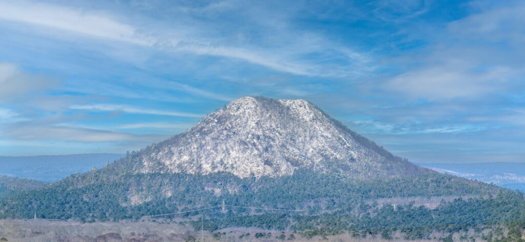
Pinnacle Mountain after record snowfall

On the night of January 9th, 2025 Little Rock Arkansas had one of the heaviest snowfalls on recent record.  At my house I recorded at least 14 inches.  One of local favorite shots is the view of Pinnacle Mountain which can be seen very clearly at the end of my street.  The day after the snow the sky was still grey and not clear and attempting to get a good shot of the mountain would have been a waste.  However this morning the skies cleared and I was able to hike down to get a much better view.  I had hoped to still catch all the snow in the pine trees near the base, however most of that was gone.  However the mountain was still covered with snow which is rare event so I was rewarded with this view.

I shot this image in 2 frames with a Fuji GFX100II and the 500mm GF lens.  All of the shooting on this morning was handheld with IBIS and OIS enabled and the results were spectacular.  The details that this combination of lens and camera can capture are most impressive.  I should add later some detailed crops but I am not sure that the effect can really be seen.  This view is about 3 miles or more away from where I was standing and the individual tree limbs on the mountain and around the base are clearly visible.  I shot with 3 frame exposure brackets and worked up only 2 frames from the total of 6.  I was using Iso 80 with shutter speeds ranging from 1/650 to 1/250.

Catching this shot was lucky for me, in the past after heavy snowfall the snow did not stay on the summit of Pinnacle as long.

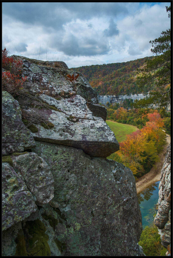
01/08/25 Fall Scene from the Buffalo Red Bluff Overlook

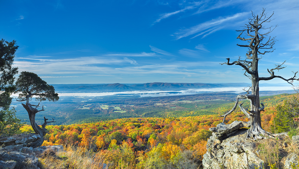
One of the many great bluff/overlook locations on the Buffalo National River is Red Bluff. Actually there are at least two different Red Bluffs. One is this one which is below Gilbert the other below Woolum, closer to Hwy 65.

I tried to find this spot for several years, before locating it in 2022. The spot where you actually stand to take the picture is literally right above the drop off. If you prefer to not have the old twisted Cedar tree trunk in your image, you have to be pretty brave and get to where your feet are hanging off. It pays to remember that the slope behind you is actually about 45 degrees and all loose gravel, so I do not go any lower towards the edge.

I took this shot with an Hasselblad X2D, and 21mm lens, on a tripod, and shot the image in a 3 shot exposure bracket. I have found that the X2D is very selective on exposing highlights correctly and it’s very easy to blow out skies. You do have considerable shadow push at base ISO of 64 but even so if I can, I will always shoot a bracket. The image was worked up in Phocus and then tweaking in Photoshop. As much as I hate Phocus, I have repeatedly found that it give the best color to a X2D file. Lightroom just can’t get the same look for me.

When you arrive at this location, be aware that it’s not going to allow very many photographers to be standing around so you might try to get there as early as possible and not attempt to go there on a weekend. For example, from where I was standing off to the left of center, if another person decided to come down and get below me by the tree, then they would have been in all the shots I attempted to take. This would have made post processing very difficult.

Fall in 2024 for Arkansas was another terrible year. As you can see in the image most of the color is brown. There was some nice color up by the river in many places, but when you went looking for an overlook most of the trees showed up with brown. We were lucky to get an amazing sky on this morning and it added immensely to the overall look of the shot.

01/24/24 Sunset over Walton Heights and Pinnacle Valley

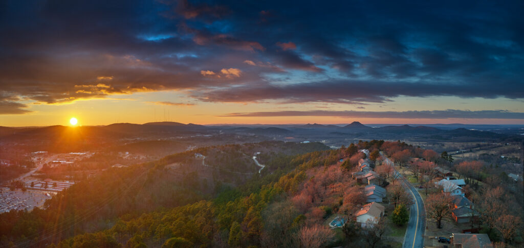
A wintertime sunset from Walton Heights in Little Rock featuring Pinnacle Mountain.
Wintertime sunset from Walton Heights in Little Rock overlooking Pinnacle Valley

There are times that the best view of a particular subject is from the air. With the use of a drone, I was able to capture this sunset in several separate images, then combine them into one single image. The dynamic range of the files is limited, so I chose to use exposure bracketing of 5 shots per image, then combining several of the single files to create one image.

The problem with a drone is that you have to be very careful when shooting into the sun as it’s very easy to totally blow out your highlights. This image was taken with a DJI Mavic 2 Pro, which has a 20MP sensor, but the sensor is nowhere near the same quality as a 35mm camera with 20MP or 24mp.

The other problem that can occur is drift, during the series of images. Even in a quick 5 shot bracket the drone can slightly drift and thus the file will not line up perfectly. If this occurs, then it’s best to use load the needed files into Photoshop, as layers, and then use the “align layers” feature. This will usually allow for a close enough alignment so you can proceed with the work.

Using a drone often gives a much better perspective overall and I always try to have a drone with me in the woods.

01/22/24 Looking through the Keyhole on Roark Bluff–Autumn

A view from the summit of Roark Bluff in Arkansas, featuring the keyhole.

One of my favorite locations in Arkansas is the Buffalo River which runs across the northern part of the state. It runs eastward eventually emptying into the White River, making it the largest tributary of the White.

I love to work the river, along it total length. Fall offers some wonderful color as various deciduous trees turn shades of yellow, red, and bright orange.

This particular spot is what I call the keyhole and is on the top of Roark Bluff. Roark bluff is one of the single largest bluffs on the river and is near the town of Ponca. You can get to the base of the bluff by stopping by the Steel Creek landing. Directly below Roark is Bee Bluff, which can offer a wonderful view at sunset in the fall.

I took this shot with a Fuji X-T2, in a series of bracketed exposures to combine later as a single image. From this view you can see the upper end of Roark Bluff as it winds around to the left and in the lower part of the image you can see the Buffalo River and the row of Maple and Gum trees that line the river bank on the left side.

10/14/16 Fall starting to show it’s colors in Arkansas, but still a lot more needs to happen

This photograph featues the fall vista along Bee Bluff which is on the Buffalo River.  This row of gum trees provides a wonderful display of color the problem is just catching the right light.

This photograph featues the fall vista along Bee Bluff which is on the Buffalo River. This row of gum trees provides a wonderful display of color the problem is just catching the right light.

It’s already the 14th, and in Arkansas the fall colors are really just starting to show.  Arkansas had a very wet August, but extremely dry and hot conditions prevailed during September.  Most of the creeks dried up again and the trees did take a hit for sure.  As of last week, the areas up around the Buffalo river have some nice color beginning to show, but still I am not seeing enough to feel that it will be a uniform color year.   Instead I feel we will have individual species of trees starting to change.  So for now up on the Buffalo, the Sweet Gums and Maples are starting to change, but the oaks and hickory trees have very little to show.

Closer to home around Pulaski County, I visited the Pinnacle Mountain State park this morning.  There were spots of yellow along the road, but also quite a bit of brown.  In my local neighborhood, I am seeing more brown than anything else and we have a very good cross section of trees to look at.  Around the Maumelle River Valley, I am seeing some nice yellows off in the distance so hopefully in about a week the true nature of the color will show.

I still need to travel out to Flatside Pinnacle, as the fall display there can be one of the best in the state, but it always tends to be much later in October.

As of last week, the colors at Sam’s Throne were just starting to show, again mainly in the gums and maples.  Sam’s tends to peak the first weekend in November and has never been a disappointment for me.

Rainfall is still way off for this time of the year even though rainfall totals show Arkansas way ahead for rain.  The Ozarks took a nice rain yesterday, but it only seemed to effect the middle of the Buffalo River.  The Carver gauge showed around 3000 CFS running in the river which is a huge amount of water for this time of year so somewhere nearby the Buffalo watershed received a lot of rain.  Richland is up just a bit to 20 CFS, but that is still not enough to really make the creek attractive for photography.  The upper Buffalo is still very low in the 5 to 10 CFS range.   I have not checked the Cossatot, but I don’t believe it received any rain of measure.

Next week, the heat is back, so it’s still a guess as to if the state will have a good fall display or not.


09/23/16 Fall is starting a bit early in Arkansas–Buffalo River Trip

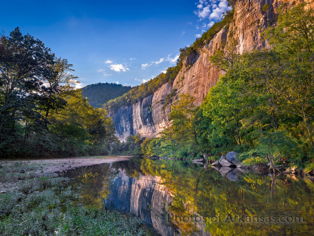
Late afternoon light creeping along Roark Bluff on the Buffalo National River

Late afternoon light creeping along Roark Bluff on the Buffalo National River

Another example of the amazing Dynamic range of the Phase One IQ100 digital back.  This is one exposure and I was still able to hold my shadows and keep the highlights in line.  This camera still continues to amaze me. What an amazing improvement over the CCD technology of the past.

On my recent trip to the Buffalo, I was surprised to see that the fall colors have already started to display.  This shot was taken on the upper end of the Buffalo River at Steel Creek featuring Roark Bluff.  The water is low, as expected for this time of year, but I was surprised by the amount of color already starting to show.  Along with several tree species that have just turned brown.   In this shot you can see that the Sycamore tree on the right side has a nice golden brown color and the trees to the immediate right edge are also showing some color.

The trees on the left are all Maple and Gum trees and since the sun was setting through them, I really could not see enough to tell what the colors might be.  But looking upstream you can see that several oaks are getting the same yellow look.

This is tough shot to take in the late afternoon, since the sun will set right at your left side.  But the reward is that the entire bluff will be lit up briefly by the sun.  In the summer months, the effect is more pronounced since the sun is higher in the sky, but in the fall you can still catch a nice yellow tint to the rocks.  I love to see the transition from yellow to grey on the bluff.

If you are lucky, you will not have any wind and can catch a wonderful reflection.   This shot is also an excellent photographic study in the morning as most times there will be some fog on the river.  You can catch the reflection and the fog both.  I opt for the other solution which is to climb to the top of the bluff and catch the same shot but from the top of the bluff.  Either way you can expect to find excellent shots.

This part of the Buffalo also is close to the Boxley Valley, which offers Lost Valley, and Elk among other great things to photograph.

12/14/15 Copying and Pasting images–Sadly it seems to be the norm that no one respects copyright rules on the web

Recently, a friend of mine sent me this link:

https://www.pinterest.com/pin/446278644299056070/


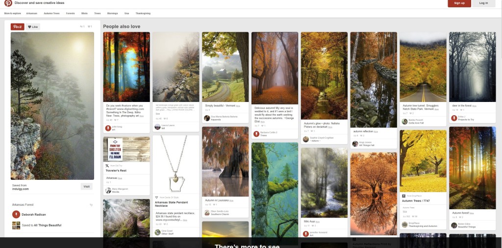
On a closer inspection as you can see here:

An example of copyright infringement

An example of copyright infringement


In this case a person named Deborah Radican, pulled a copy of one of my best images, “Foggy Morning View, on the Buffalo River”, from a site called indulgy.com.  There is no mention of me, or my work and the fact that this particular image is offered for sale on my website.

It seems now to be the normal process when someone sees a photograph on a website, even if the site is copyright protected, just to go ahead and screen print the shot, and post it on their site, be it Facebook, Pintrest, or God Forbid, Twitter.  The world has become a “whats in it for me now” type society and there is no longer any respect for the person or persons working.  The fact that this particular photograph was very special to me, and took a lot of time to get right, is just cast aside.  What concerns me even more, the fact that on indulgy.com, the image is shown with my name cropped out.  This means that someone actually took the time to copy the shot, and then crop out my name thus not giving me any credit.

If you want to take my work and copy it to your site, at least ask me, as all I want is credit for the work.  In this case, a photograph that has sold across Arkansas, and has been hung in both Hospitals, Business Offices and homes, now has become just totally trashed on the web.  The image is poorly shown, and the color is off.  If someone decided to take my photograph, and then work on it, well, that is beyond me.  If you want to do that, then hike up there yourself, wait for 4 hours till the sun gets just to the right spot, then shoot it.

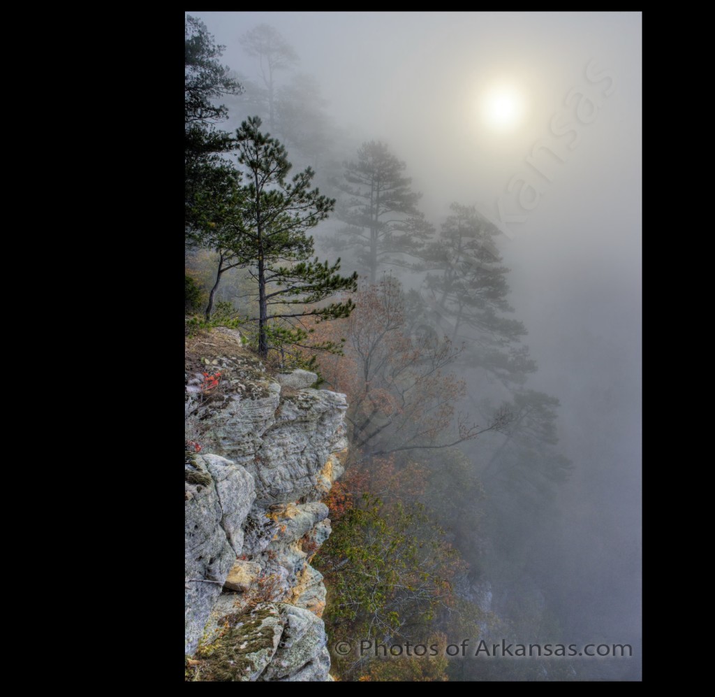
This has forced me to so something I have not wanted to do, add a visible copyright to all my work.  This mars the shot on the web and takes away from the image, however there really is not other recourse since I have found so many of my shots just haphazardly pasted on other website.  I just it’s just a sign of the times and points to just how much damage the iPhone has done to photography overall.


New version of Foggy Morning View with Copyrighting

New version of Foggy Morning View with Copyrighting


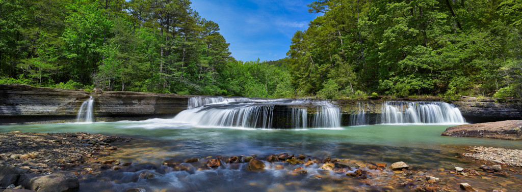
11/10/15 Springtime at Haw Creek Falls–A great place to spend a day in Arkansas

Haw Creek Falls, waterfalls in Arkansas

Springtime View of Haw Creek Falls in the Arkansas Ozarks

Taken with a Phase One IQ260 and Arca rm3di tech camera/40mm Rodenstock lens

This is a typical day at Haw Creek falls, and I was again lucky to be there without anyone else to stand around and get in the way during the shoot.  Haw Creek is a lovely smallish creek that runs in the Big Piney Creek, not far from these falls.  The falls are impressive since there is a large ledge that runs all the way across the creek and in higher water conditions the water will start to consume the entire ledge.  I like to catch water about like this, just enough to keep most of the ledge in play but not too much to flood out the rocks below the falls.  To get this shot, I used my Arca rm3di camera which allows movements like a large format camera with my digital camera back.  The shot is actually a composite of 3 images, Left, Center and Right.  The Left and Right segments represent 16mm of shift in those respective directions.  This allows you to create a very high resolution panorama without any of the issues like parallax.  The lens I used was as 40mm Rodenstock HR-W which allows for an excellent field of view when shifted.

You have to be careful when working Haw Creek as there tends to be a lot of wind blowing down the creek.  In most cases, I prefer to take a 1 to 4 second exposure of the water which in most cases will have a lot of wind blur in the trees.  So you have make sure to cover the tree movement with a second series of exposures around 1/125 to 1/250 to stop the wind movement.  It’s a simple process to combine the files later since I am using a tech camera and the movements are very precise.  To allow the longer exposures I used both a Circular Polarizer and a Neutral Density filter.    The polarizer will help with glare on the water and rocks and adds about 1.5 stops of exposure to the shot.  As this was a bright day, I had to use a 1.2x ND filter.  When I was taking the faster exposures for the trees, I left the polarizer on, but took the ND filter off as I no longer needed the extra exposure compensation.

As I already mentioned, Haw Creek Falls, tends to be overrun with people during the peak times of the year.  The best day to go is a Monday as there will not be as many people at the campground and thus less traffic around the falls.  There are some great swimming spots above the falls in the large pool that is created by the ledge.  It’s a great place to head to when you know you have some water running in the creek.  Also the Ozark Highlands Trail runs right by Haw Creek falls, so if you are planning a hike on this part of the trail make sure to stop and take a look.

The falls run year round, but the best times to photograph them are in the early Spring and winter when water levels are more consistent.  In the summer and fall you can sometimes get lucky after a locally heavy rainstorm and catch the falls running.  The fall display here is wonderful if you can catch it at the right time.

04/30/14 New Images added to my Arkansas Panorama Gallery

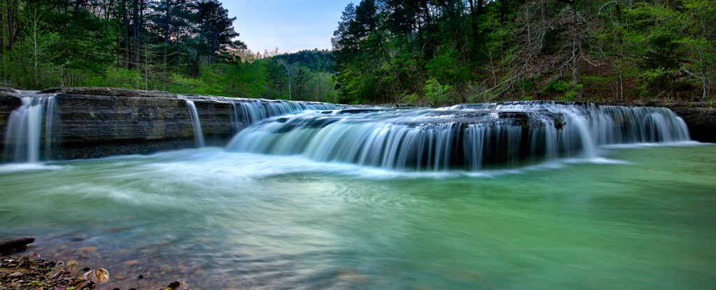
Haw Creek Falls Sunset Arkansas

Haw Creek Falls in Arkansas, taken at sunset.

I have recently added several new panoramas taken throughout Arkansas to my Panorama Gallery.  You can view the images here:

Over the years, I have started to shoot more panoramas than standard format photography as I feel it gives a better view of landscape subjects.  Many times I will shoot both ways, but after reviewing the images I will come back to the panorama images.  I have found three  ways to accomplish this:

1.  You can take the shot in a panorama format, which involves using special equipment to keep the foreground and background in focus.

2.  You can take one high resolution image and crop into it with a 3:1 ratio.  This requires a image of 50MP or more to allow for a large print.

3.  Setup your camera for a nodal pan.

With my current equipment I can work this either way since I can now use my Arca rm3di camera to allow for a stitching capture.   I can pick up as much as 18mm of new image details on each side of the center, and since I am stitching, not panning the camera, I will not have to worry about parallax issues.  Parallax comes about when you pan your camera/lens combination without consideration for the nodal point of that particular camera/lens.  What will occur most times with parallax errors is foreground and background elements of your subject will not line up.

With a digital back of 60MP it’s also possible to crop into a single image to a 3:1 ratio which is the standard for panoramas.  This most times will leave me around 25MP to work with and from that I can get a print sized to around 24″ x 60″ or 36″ x 72″.  Working this way is much faster as you don’t have to worry about merging the stitched images together.  During this process you can run into color balance issues or blurring, as the wind may have picked up during the stitching process and effected one of the 3 stitches.   This process allows you the greatest amount of freedom to compose as you can shoot with a tripod if the shutter speed allows it.

When time and conditions permit, I will try to work in a nodal pan also.  This is by far the most complicated of the three solutions as you have to have several factors taken into account:

1.  You will need a tripod that is level

2.  Your camera and lens need to set to the correct nodal point

3.  A panning head is usually required to help keep the panning lined up.

4.  Some form of stitching software will be needed to put the images together

5.  Most times even with a nodal solution, there will be issues while lining up the images

6.  Working with wide angles lenses is still complicated

The main reason I don’t prefer to use this setup is that you need to be level as if you pan with a non-level tripod, you will add all types of distortions to the final image.  Many times even if you have the camera/lens set to the correct nodal point, many of the images won’t come together correctly since I am mainly working with wide angle lenses.  This solution does allow for the highest amount of final resolution as you are using about 80% of the sensor on each shot the rest being lost to overlap.

Panoramas are very challenging, but can offer the photographer an excellent final image that can be printed in many more possible output solutions.


06/15/13 Gunner Pool Campground and 5 others closed to swimming due to e-coli outbreak

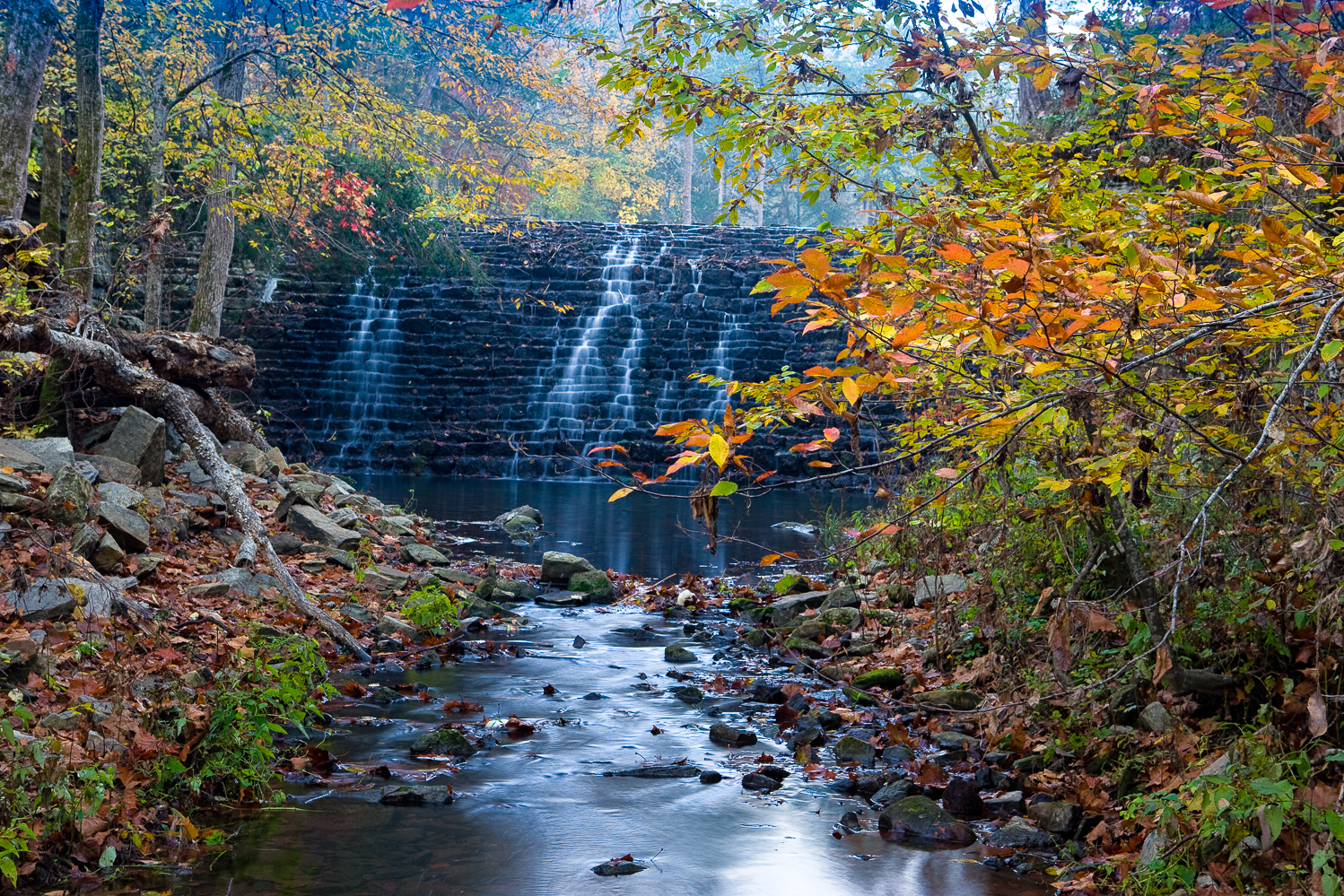
Fall view of Gunner Pool CCC dam at Gunner Pool Campground

Fall view of Gunner Pool CCC dam at Gunner Pool Campground

After reading the Arkansas Gazette yesterday, I noticed that several noted Arkansas swimming areas were closed due to a outbreak of e-coli in the water.  One of the areas mentioned was one of my favorite spots in Arkansas, Gunner Pool.  Sad to here this, and surprised to hear it due to the recent spell of high water we have had in Arkansas.  However Gunner Pool does tend to get a lot of use and the road will allow larger RV’s to make it into the campground.

This picture is of the CCC dam that creates the actual Gunner Pool, which is off to the far side of the campground and missed by many people who think the large pool in Sylamore creek is Gunner Pool.  This rock dam was made with local stone and created in the 1930’s by the CCC.  There was a formal CCC camp at Gunner Pool for many years.  I took this photograph of the dam back in 2008 after a rain storm.  The fall colors were just starting to peak.

Gunner Pool Campground and Barkshed Campground swimming areas were both closed along with the larger swimming area at Blanchard  Springs.  This implies that the problem is in Sylamore Creek itself and may be from some farm effluence running off into the creek.  These types of breakouts tend to occur later in the summer after the water has started to stagnate.  However Arkansas just had record streamflows less than two weeks ago and I am sure that Sylamore creek was effected.

Hopefully this ban won’t be for the rest of the year, but with all of the layoff and cutbacks in the federal programs, it’s hard to tell what’s going on anymore.  Just recently a large number of campgrounds along the Buffalo river had their facilities reopened since locals volunteered to keep them clean.  Gunner Pool is a full service campground with facilities, Barkshed is more of a primative site with tents sites only.  Both are bordered by Sylamore creek.

Sylamore creek is a great spot to visit in cleaner times.  It’s one of the best small creeks in the Arkansas for day hiking and if you hike up the creek from Gunner Pool you will be treated to several nice small bluffs and rapids that make for great photographic subjects.  There is also a formal backpacking trail that runs from Gunner Pool to Barkshed.  This same trail also runs all the way to Blanchard Springs caverns.

06/13/13 Review of recent highwater levels in Arkansas Ozark and Ouachita streams

Bills Thrill rapid on Richland Creek in low water

Bills Thrill rapid on Richland Creek in low water

In Arkansas, there are times of drought and times of heavy rains which create high  flows in Ozark and Ouachita mountain streams.  In a normal year, most of this high water will happen in mid to late March and most of April, and starts to wind down by mid May.  Usually by June stream flows in all but the largest trunk streams will be down to a very small flow.   However this year, all of that logic was thrown out the door as Arkansas had quite a late spring with freezing temperatures still happening into late April.  As May rolled in strong storms developed several times during the month, however by the heaviest amount of rainfall came in a period over 2 days, 05/30/13 and 06/01/13.

The heaviest amount of rain fell in the southwest part of the state, and this brought up all the main streams.  There was locally heavy flooding and some fatalities occurred during the flooding.  I tend to gauge the stream flow in Arkansas by reviewing the levels of what I determine are critical trunk streams:

  1. The Cossatot River in the southwestern corner of the state
  2. The upper end of the Buffalo National River near Ponca Arkansas
  3. Richland Creek in the center of the Richland Wilderness

I use the USGS gauges, which are online at this location.  You can get an excellent feeling for how much rain has fallen by looking at the stream flow increases.  If you look at the series of images from the gauge on the Cossatot, you can see that the stream rose to around 30,000 CFS (Cubic Feet per Second of flow) in around 2 hours.  This is classic flash flooding and is a very dangerous time to be out driving around on local road.  What’s also telling is just how fast the Cossatot fell back to a “normal” level.  By looking at the charts, you can see that really before daylight, the Cossatot had already dropped back down to a much lower level.  What is even more interesting, is that in the 2nd heavy rainfall on the night of 06/01/13, the Cossatot rose back up to close to 20,000 CFS again in less that 2 hours.

The first graph shows the two peak levels, of 30K and 20K in a total overall time frame of less than 24 hours.  The 2nd graph shows the final peak reading on 06/01/13 where the river recorded over 20K CFS. I have seen a video taken by Max Wellhouse way back in the late 1990’s of the Cossatot at 10,000 CFS, so I can only imagine it at 30,000.  The 6 falls of the Cossatot would be a site to behold if you could even get down to shoot around them.  I am assuming that the water would be pretty maxed out in the narrow canyon that is created around the 6 falls and any viewing would have to be done from above the level of the falls on the surrounding bluffs.  So what about the northwestern part of Arkansas, well not quite as much rain fell, but Richland creek most definitely saw the same double peaking like the Cossatot.

Anyone who know me or my work, knows I am a bit partial to Richland Creek.  Hands down it provides some of the best photographic studies in Arkansas.  This is true in winter, spring, summer and if you are lucky fall.   Catching Richland with a good flow in the fall is very prone to luck.  Richland is enjoyed by a huge cross section of recreation seekers in Arkansas and other local states.  This includes:

  1. Kayakers
  2. Hikers/Backpackers
  3. Photographers
  4. Hunters
  5. Fishermen

There is a great primitive campground about 1/2 way of Richland’s length where forest road 1205 crosses the creek.  Since 1974 I have hiking, photographing, or kayaking on Richland and know it very well.  By gauging Richland creek you can get a great feel for how high the smaller tighter streams are running, like Falling Water Creek, Bobtail Creek, Big Devils and Long Devils creeks.  All of these smaller creeks have individual features that make them appealing.  On the 30th of May, Richland rose up from around 150 CFS to over 9000 CFS in less than 3 hours.  This much water on Richland is easily what I would call a flash flood, and would most definitely cover the bridge at FS 1205.  This amount of water may also start to flood into the lower level of the campground. What also has to be remembered is that at the campground, Falling Water Creek also comes into Richland.  Falling Water Creek would be the largest tributary to Richland, with Bobtail creek being the 2nd.  If there was 9000 CFS at the Richland gauge, easily 1/3 of it was coming in from Falling Water Creek.   In the images below you can see just how fast Richland rose up.

[Read more…]