From the BlogSubscribe Now

01/11/25 Near Record Snowfall for Little Rock

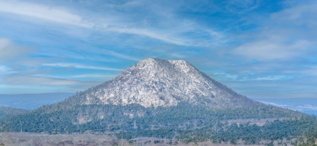
Snowy Scene Western Pulaski County Pinnacle Mountain
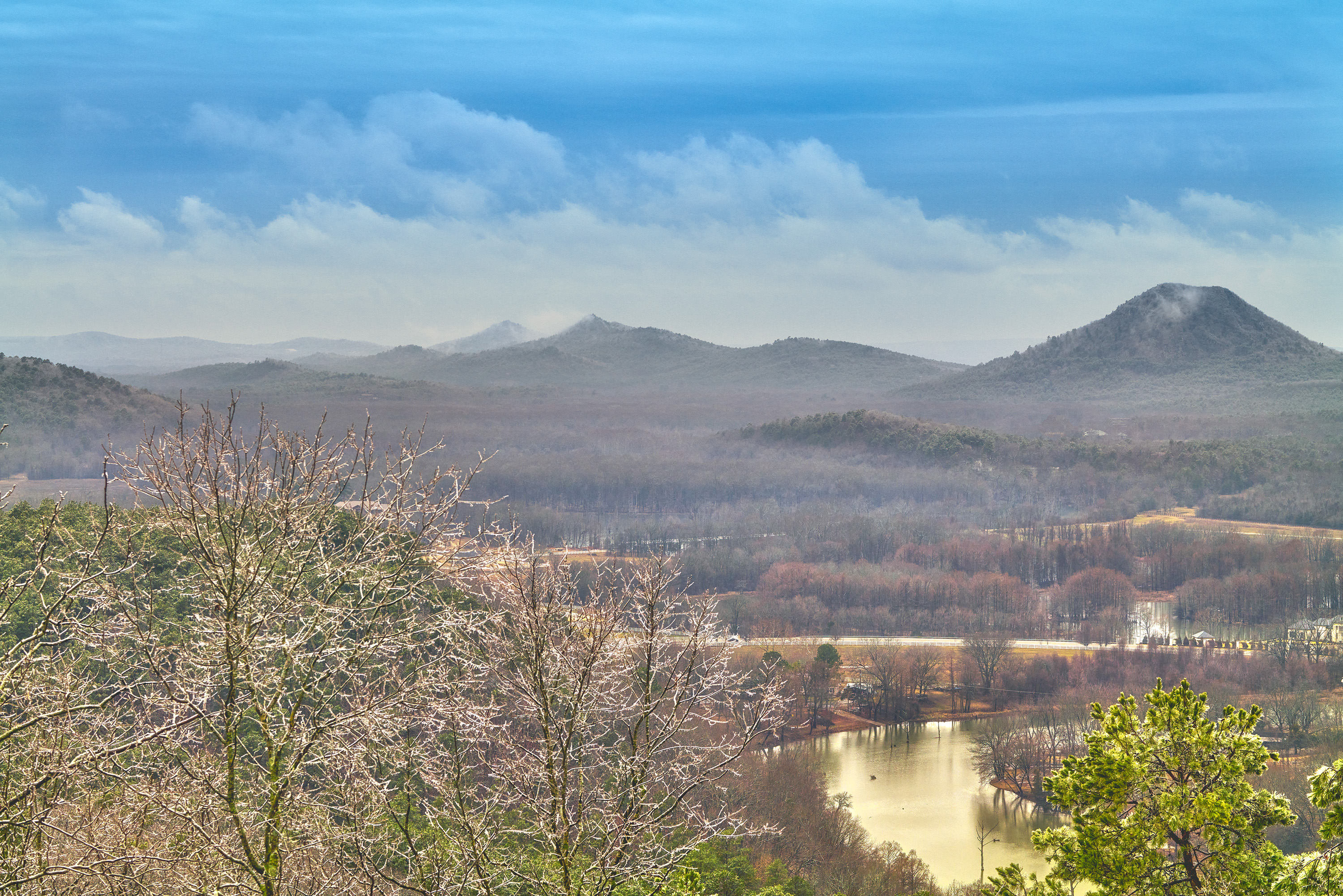
Pinnacle Mountain after record snowfall

On the night of January 9th, 2025 Little Rock Arkansas had one of the heaviest snowfalls on recent record.  At my house I recorded at least 14 inches.  One of local favorite shots is the view of Pinnacle Mountain which can be seen very clearly at the end of my street.  The day after the snow the sky was still grey and not clear and attempting to get a good shot of the mountain would have been a waste.  However this morning the skies cleared and I was able to hike down to get a much better view.  I had hoped to still catch all the snow in the pine trees near the base, however most of that was gone.  However the mountain was still covered with snow which is rare event so I was rewarded with this view.

I shot this image in 2 frames with a Fuji GFX100II and the 500mm GF lens.  All of the shooting on this morning was handheld with IBIS and OIS enabled and the results were spectacular.  The details that this combination of lens and camera can capture are most impressive.  I should add later some detailed crops but I am not sure that the effect can really be seen.  This view is about 3 miles or more away from where I was standing and the individual tree limbs on the mountain and around the base are clearly visible.  I shot with 3 frame exposure brackets and worked up only 2 frames from the total of 6.  I was using Iso 80 with shutter speeds ranging from 1/650 to 1/250.

Catching this shot was lucky for me, in the past after heavy snowfall the snow did not stay on the summit of Pinnacle as long.
01/22/24 Looking through the Keyhole on Roark Bluff–Autumn

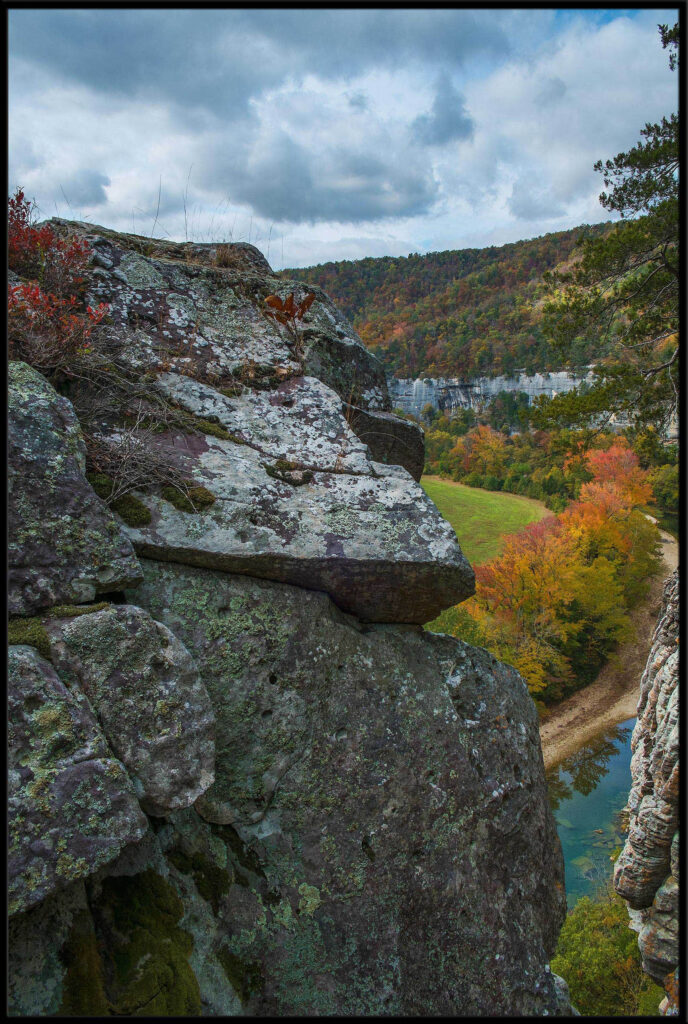
A view from the summit of Roark Bluff in Arkansas, featuring the keyhole.

One of my favorite locations in Arkansas is the Buffalo River which runs across the northern part of the state. It runs eastward eventually emptying into the White River, making it the largest tributary of the White.

I love to work the river, along it total length. Fall offers some wonderful color as various deciduous trees turn shades of yellow, red, and bright orange.

This particular spot is what I call the keyhole and is on the top of Roark Bluff. Roark bluff is one of the single largest bluffs on the river and is near the town of Ponca. You can get to the base of the bluff by stopping by the Steel Creek landing. Directly below Roark is Bee Bluff, which can offer a wonderful view at sunset in the fall.

I took this shot with a Fuji X-T2, in a series of bracketed exposures to combine later as a single image. From this view you can see the upper end of Roark Bluff as it winds around to the left and in the lower part of the image you can see the Buffalo River and the row of Maple and Gum trees that line the river bank on the left side.

01/14/24 Sunset from Pinnacle Mountain Little Rock, AR

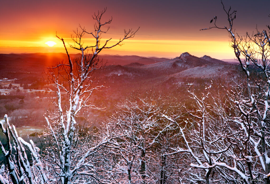
Snowy sunset from Pinnacle Mountain, Little Rock Arkansas
Snowy Sunset from Pinnacle Mountain

This is what might be available the hardy photographers on next Monday or Tuesday as we are going to get another snowy period of 2 days. My days of hiking up Pinnacle on a snowy evening are over however. I wanted to share this image as it brought back some memories.

Arkansas snowfalls are rare in Little Rock, and often times you will get a snowy morning and then as the skies start to clear, you can catch a sunset with the sun shinning on the sun. This particular evening was special as the snow was a wet one and stuck to all the tree branches.

I used a Canon 1ds MKII for this shot and 24-70 lens, which was my go to solution for many years until Nikon came out with the D800. I had more trouble coming down than going up as the snow was very slushy and made the down hike much more dangerous. I was on the part of Pinnacle that I call the nose, which is a solid rock area with no trees. It’s made up of large flat rocks some of which are as long as 12 feet, so if you slip you are going to slide down a long way.

Due to the warning light, I had to shoot quick and all the shots were down hand held. I waited until the last few minutes hoping that the sun would break out from the clouds and I was rewarded with this shot. One of all time favorites of the wintertime at Pinnacle.

01/14/24 Winter View of Pinnacle Valley

Clearing Winter Ice Storm over Pinnacle Mountain

Hopefully this is what the valley will look like in about 3 or 4 days as we have a lot of snow and ice scheduled to hit. This image was taken in 2023 after the only real winter weather we had in Arkansas for 2023. I was hoping to catch the sun on the icy coating in the trees, which I did.

For the image I used a Leica SL2, and 90-280 lens at approx 120mm. I used ISO 100 and took 2 sets of bracketed images in what I call a short pano. Using this method, I was able to later combine the files into a single image using Ptgui stitching software.

The final image shows the effects I was looking for, mainly to capture the sun on the icy trees in the foreground but also keep the dark skies over Pinnacle mountain which added quite a bit of nice contrast.

01/12/24 Fall Scene, Pinnacle Mountain

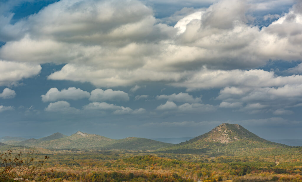
Sun and Storm Clouds over Pinnacle Mountain

My Favorite view of Pinnacle, this time early fall. The trees in the valley have just started to turn to their fall colors. On this day, the sun was at my back and was illuminating the valley as a strong storm was starting to blow in from the west.

This photo was taken with a GFX100II, and 100-200 lens at approx 120mm. I captured the shot with two frames and then merged them together into one larger file using the Ptgui software. Capture One was used to convert the raw files from the GFX100II.

Focus was at Infinity and the overall details of the image were impressive, as even the small details of the rocks on Pinnacle could easily be made out.

You can view the image in my Pinnacle Gallery by following this URL:

https://photosofarkansas.com/gallery/photo.php?src=galleries/Views_of_Pinnacle_Mountain/26_Sun_and_clouds_over_Pinnacle_Mountain.jpg

01/11/24 Hasselblad XCD Camera lenses, all out of stock?

Most interesting in that today I noticed that you can easily purchase the Hasselblad XCD2 100MP camera pretty much anywhere in the United States, but try to find any of the following lenses, the 38mm, 55mm or 90mm. All of them are out of stock until around March 2024.

What type of manufacturing/supply line design is this, where you can purchase a camera body, but no lens for it. As far as I can tell, the supply for the new style XCD lenses has been tight for many months.

However checking B&H, Adorama, Capture Integration, and Camera West, all of them display the same message, “out of stock, supply expected March 2024”.

So my question?, How do you sell a new XCD 2 camera at all since none of the 3 main focal length lenses appear to be in stock

Example of lens supply for Hasselblad XCD

Hopefully this will improve sooner than later. However this also makes me wonder how fast you could get a replacement lens from the DJI/Hasselblad repair center? Since DJI now has full ownership of Hasselblad I have not followed closely how well they are handling repairs of the lenses. Since all XCD cameras do not have a focal plane shutter, you are 100% dependent on the leaf shutter in the lens.

03/14/19 Official Buffalo River Brochure now features my photography

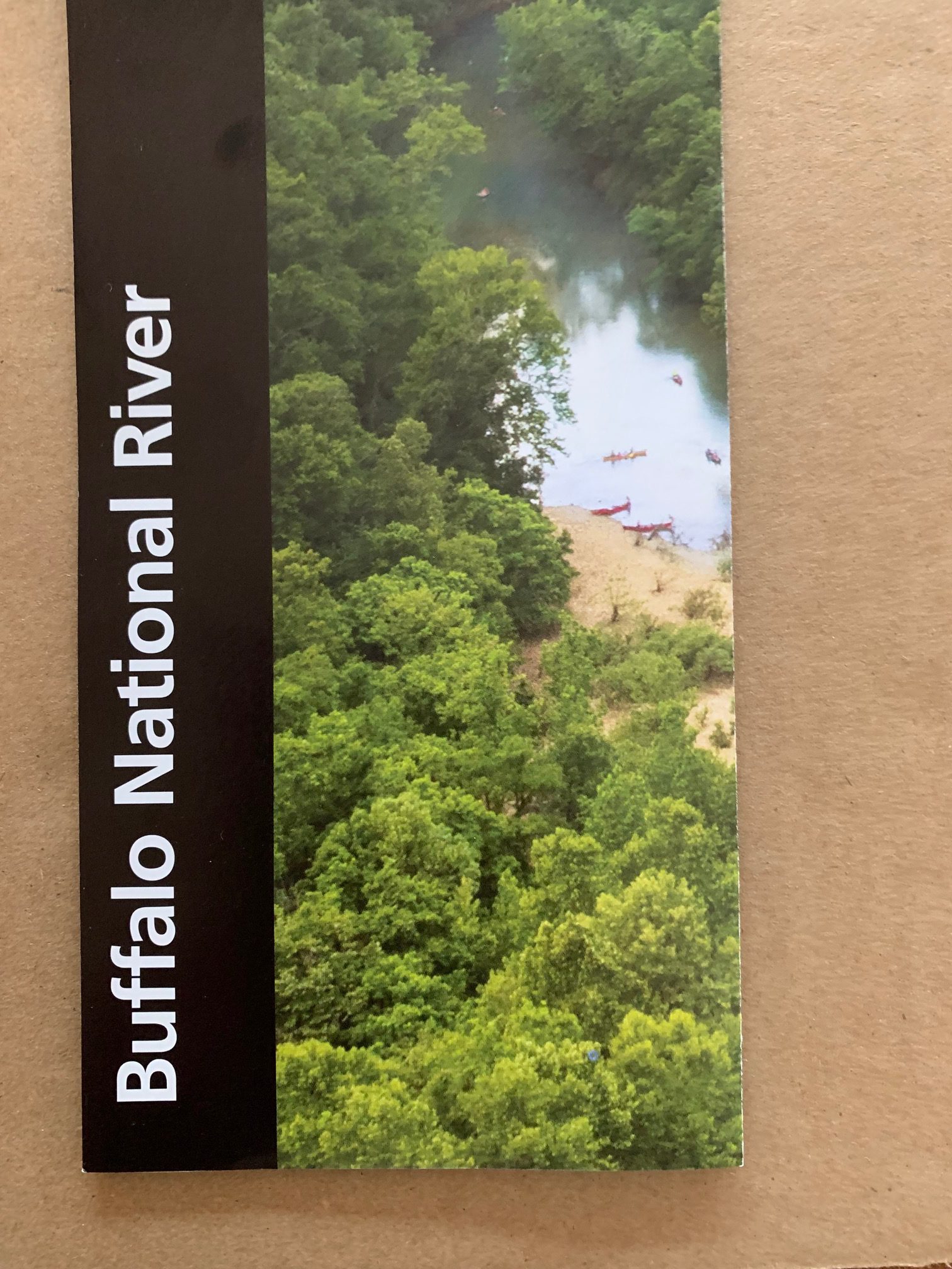
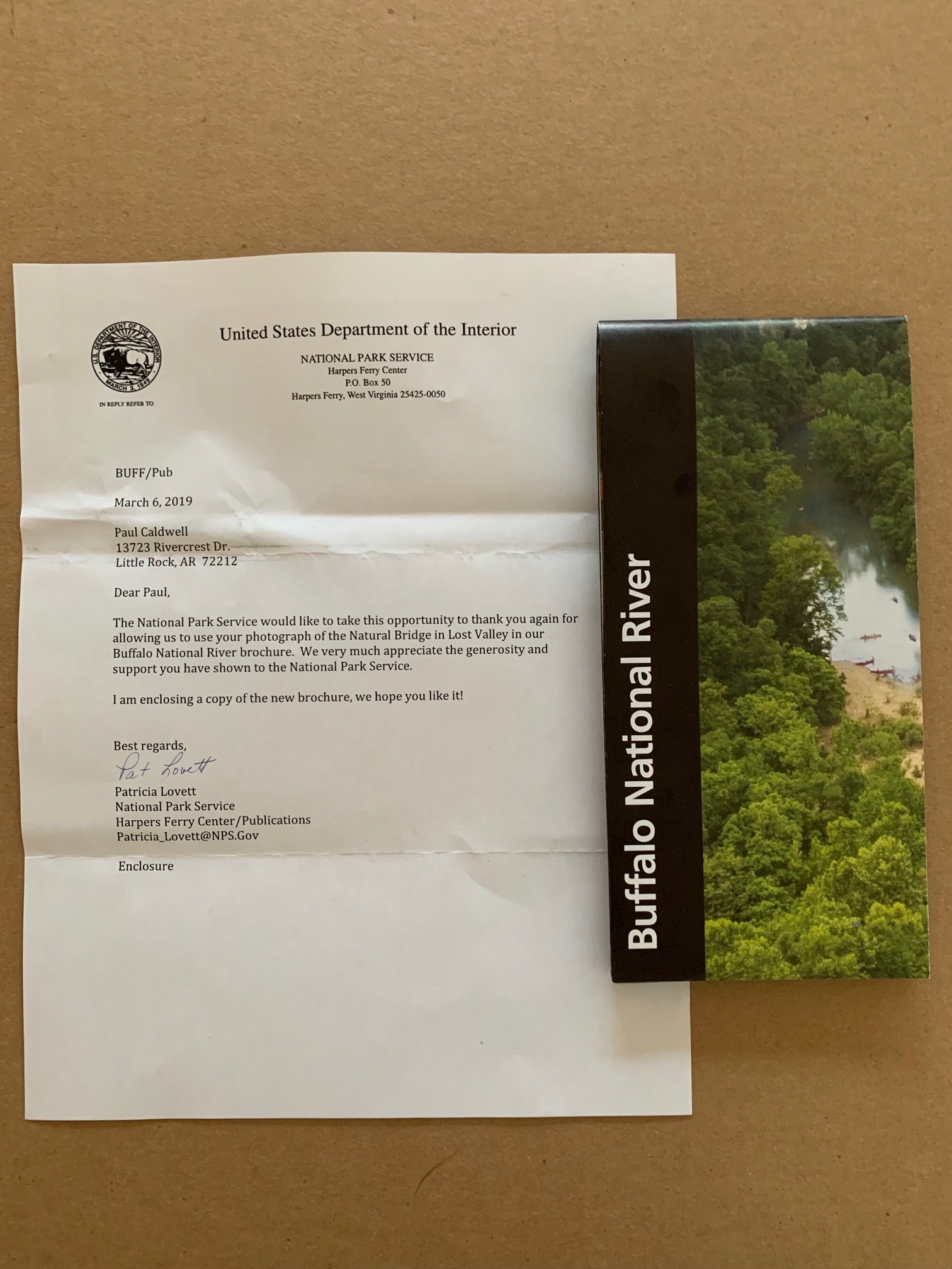
If you travel to any United States National Park, you are familiar with the official brochures that you can pick up when you enter the Park.  This is copy of the most recent one for the Buffalo National River, in Arkansas.


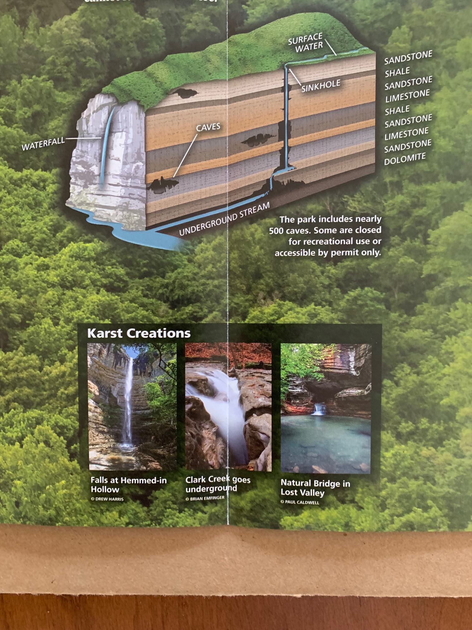
Last year I was approached to have one of my images included in this brochure.  The image is not the cover, which in it’s own right is a great shot taken from the goat trail on Big Bluff.  But instead the park service used my shot of the Natural bridge in Lost Valley.

Lost Valley which is one of the most visited spots on the upper Buffalo, offers so many subjects to photograph, I can’t begin to list them all.  It’s interesting to note that in the brochure, the Park service used two different images.  My shot and one from another photographer showing where Clark Creek runs under ground at certain water levels.

My thanks to the National Park service for considering my image which is the shot of the Natural Bridge.


Nice to get a photo credit for this publication.  You can see this image in my gallery on www.photosofarkansas.com

http://photosofarkansas.com/gallery/photo.php?src=galleries/Arkansas_Ozark_Gallery_No_1/01.1_The_Natural_Bridge_in_Lost_Valley_near_Ponca_Arkansas_on_the_Buffalo_River.jpg

The Buffalo River is one of the most beautiful places in the United State, and I love to spend time there.


If you are coming to Arkansas, make a plan to either float on the Buffalo or enjoy some of the many hundreds of miles of hiking trails.


Written for paulcaldwellphotography.com please do no reproduce or reprint any of this content without permission. 

No Drones allowed in Arkansas State Parks, without a permit–Written 06/14/18

Drones Arkansas State Parks

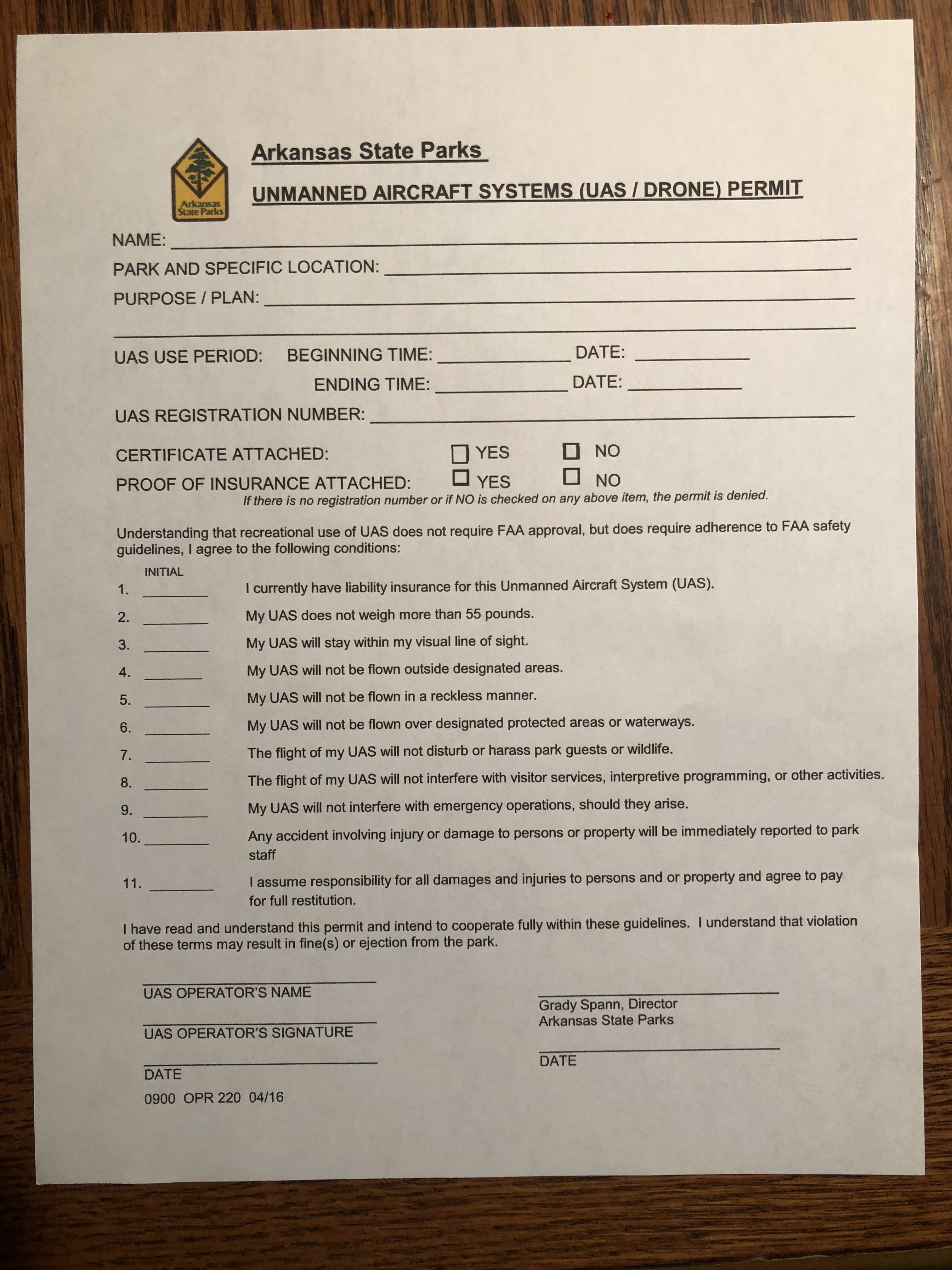
Permit form for Drone Flight, Arkansas State Parks


If you are planning to fly a drone in an Arkansas State Park, you will need to contact the office of the Director of Arkansas State Parks, in Little Rock.  As the the beginning of 2018, it is now necessary to have a permit to fly in any of the Arkansas State Parks.  The permit can be obtained by contacting the Directors office in Little Rock, and they will email you a copy to fill out.

I was flying on Petit Jean, from Stout’s Point back in late March, a spot I had made many flights from previously.  I like this spot as you can get up with no clearance issues and quickly get out away from the mountain.  There is a small airport on top of Petit Jean, and you will get the standard warning about such fields.  My flights were always out away from the mountain and around to the face of Stouts point.

On this particular afternoon, I had just taken off and a park ranger stopped and asked me if I was flying a drone.  I replied yes, and he told me that “No Drones are allowed in Arkansas State Parks, without a permit”.  I was a bit taken a back by this since I regularly checked the Arkansas State Parks website for such rules, and there never has been anything posted.  I told the ranger this, and he just shrugged his shoulders, and stated, he did not have any control over what and when something is added to the main website.  But he was quite clear about no flying in the Petit Jean State Park.

The next day I contacted the Office of the Director of Arkansas State Parks, and was told that what the ranger had stated was correct even though it’s not posted anywhere.  Strange but true.  Not sure how long it would take to edit the website to fix this, but probably not too long.  I was sent the above form and told that it had to be filled out and returned for approval.  I also called Mt Nebo, Mt Magazine and Pinnacle Mountain State Parks, and was told the same thing, no flying.
A few thoughts:

The permit is very straight forward, but very restrictive.  Note also you need to have proof of liability insurance.   They are not looking for something like “Verify”, but a actual policy, and they want to see the policy number.  Notice also, they have asked to have the dates, and times of the flights listed.   This is Arkansas, where the weather can change in minutes so to list the actual time of flight is very limiting, as odds are at that time frame or day, you will have weather issues, or wind or both.  No point in traveling a couple of hours with a permit only to arrive and have a windy or rainy afternoon.  It would be much better if the permit allowed for a full day of flights, and also allowed for a range of dates, like 5 days.  An example would be:

I would like to fly during the time of May 5th through the 10th.  My flights will be limited to launching from 8:00 am to no later than 10:00 am and I will be making 3 total flights.  I will also only be flying from spots where I can stay away from congestion so my drone will not disturb anyone else.


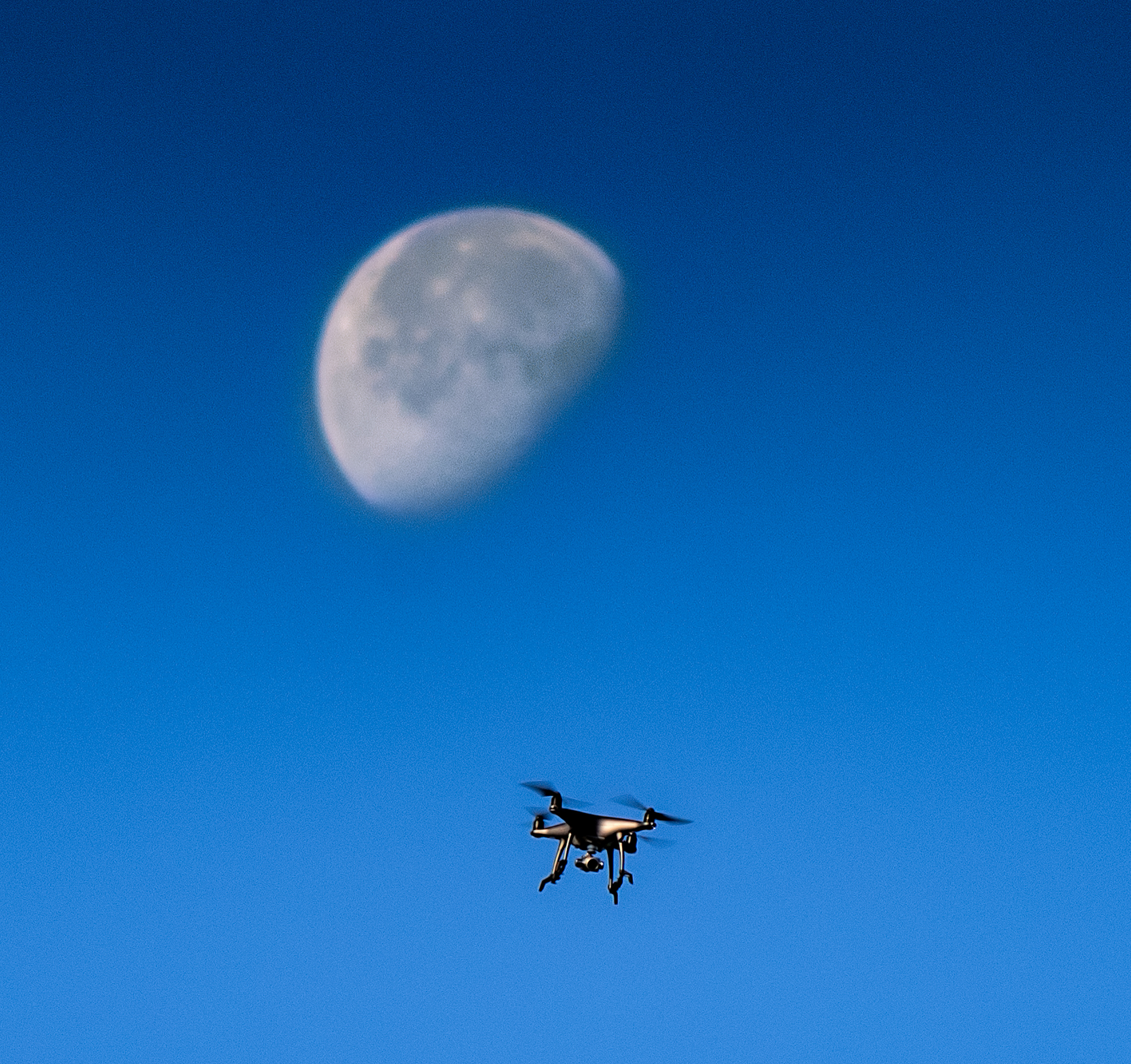
Phantom 4 Drone in flight

Phantom 4 drone up in the Arkansas sky against the moon

This would allow a lot more flexibility.

It’s most unfortunate that Arkansas has chosen this no fly policy.  There are plenty of spots where a flight can be conducted where no one else is at any risk.  Stout’s point is a great example as you can launch from the far side away from the parking area, and fly out and away from the mountain.  You can also stay at a altitude as to not endanger any aircraft planning to land on Petit Jean’s airport.

Consider also Cossatot State Park.  Very remote, and on a weekday, you are lucky to see anyone else in the area.  Most drone flights are less than 30 minutes, so the odds of disturbing anyone else are slim to none.

Now if you go and fly over Cedar Falls on Petit Jean, sure you are going to be noticed and be a risk to others, especially if you happen to loose control of your drone.  It’s already apparently happened a few times on Petit Jean, where a drone has crashed near folks viewing the falls.

Oh, and notice, the current Arkansas Drone Law (lets hope it stays this vague), only is concerning flying over installations that might be at risk, like power stations (Arkansas Nuclear One) or industry.  Two acts:

Act 1019 – Surveillance of Critical Infrastructure

Unlawful to photograph, record, or conduct surveillance on anything defined as “critical infrastructure”, defined as: an electrical power generation or delivery system; A petroleum refinery; A chemical or rubber manufacturing facility; or A petroleum or chemical storage facility.

Act 293 – Voyeurism

Unlawful to use a drone for voyeurism.

Note, I don’t believe it is lawful to use a camera in general for voyeurism.  Sad that this had to be put into an additional law.

Here is a formal link:

http://statedronelaw.com/state/Arkansas/

I believe you will get a pass the first time you are stopped, but there are fines in place for flying, and it’s possible to have your equipment confiscated.

In conclusion, I have been a resident of Arkansas since 1969, and love the outdoors.  It saddens me that Arkansas has taken such a strict policy, with what appears to be a lack of understanding of actual drone flights.  The fact that it’s required to list by date and hour the times you wish to fly, instead of giving you a larger block of dates and times is unfortunate and makes picking a good date very difficult.  For example, thought out April, I can’t remember a day when there was not an issue with either wind or rain or both.  I understand why the Director of Arkansas State Parks, is concerned.  Drones, especially the DJI Phantom or Inspire are both loud and large and thus can create a situation where other people enjoying the state park would want to complain.  Many people flying drones, consumer grade have no clue as to what to do when something goes wrong, and so it’s possible that a drone could come down in a area where a large number of people are standing.  This would be a risk of injury and thus liability.  But please note, that in all the parks, I previously mentioned it’s possible to fly a drone in remote parts of the park and or during times of low visitation and not cause any issues at all.  It’s just that many folks will choose not to do this.

People in this state will continue to fly without permits which is also unfortunate, but it’s kind of the way things seem to be going now.   But note, if you do fly in an Arkansas State Park, without a permit, you are flying without permission of the Director, and thus you will be looking over your shoulder the whole time you are in the air and that is not a good condition for flying, as you need to pay 100% attention to your aircraft.

Written and copy write protected for www.photosofarkansas.com by Paul Caldwell.  Please contact the author for a reprint.


10/14/16 Fall starting to show it’s colors in Arkansas, but still a lot more needs to happen

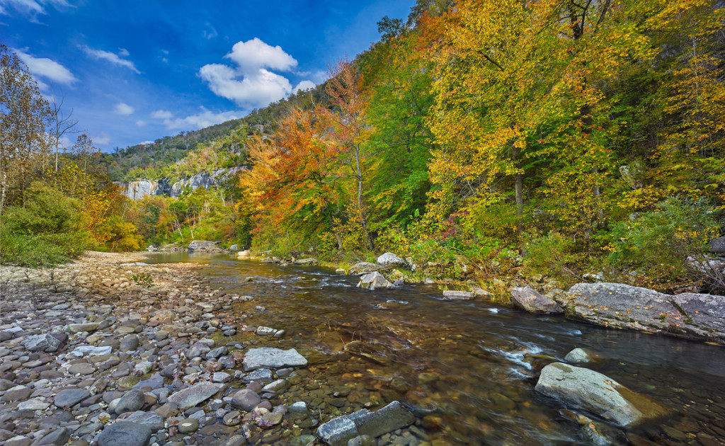
This photograph featues the fall vista along Bee Bluff which is on the Buffalo River.  This row of gum trees provides a wonderful display of color the problem is just catching the right light.

This photograph featues the fall vista along Bee Bluff which is on the Buffalo River. This row of gum trees provides a wonderful display of color the problem is just catching the right light.

It’s already the 14th, and in Arkansas the fall colors are really just starting to show.  Arkansas had a very wet August, but extremely dry and hot conditions prevailed during September.  Most of the creeks dried up again and the trees did take a hit for sure.  As of last week, the areas up around the Buffalo river have some nice color beginning to show, but still I am not seeing enough to feel that it will be a uniform color year.   Instead I feel we will have individual species of trees starting to change.  So for now up on the Buffalo, the Sweet Gums and Maples are starting to change, but the oaks and hickory trees have very little to show.

Closer to home around Pulaski County, I visited the Pinnacle Mountain State park this morning.  There were spots of yellow along the road, but also quite a bit of brown.  In my local neighborhood, I am seeing more brown than anything else and we have a very good cross section of trees to look at.  Around the Maumelle River Valley, I am seeing some nice yellows off in the distance so hopefully in about a week the true nature of the color will show.

I still need to travel out to Flatside Pinnacle, as the fall display there can be one of the best in the state, but it always tends to be much later in October.

As of last week, the colors at Sam’s Throne were just starting to show, again mainly in the gums and maples.  Sam’s tends to peak the first weekend in November and has never been a disappointment for me.

Rainfall is still way off for this time of the year even though rainfall totals show Arkansas way ahead for rain.  The Ozarks took a nice rain yesterday, but it only seemed to effect the middle of the Buffalo River.  The Carver gauge showed around 3000 CFS running in the river which is a huge amount of water for this time of year so somewhere nearby the Buffalo watershed received a lot of rain.  Richland is up just a bit to 20 CFS, but that is still not enough to really make the creek attractive for photography.  The upper Buffalo is still very low in the 5 to 10 CFS range.   I have not checked the Cossatot, but I don’t believe it received any rain of measure.

Next week, the heat is back, so it’s still a guess as to if the state will have a good fall display or not.


02/05/16 Somewhere new in Arkansas-White Oak Mountain in the wintertime

White Oak Mountain creeks

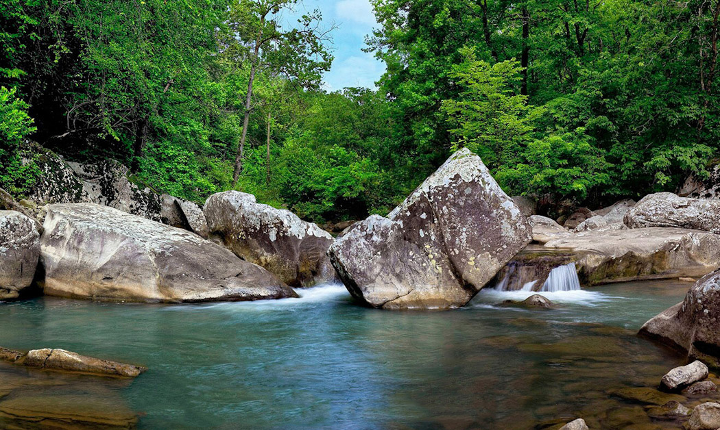
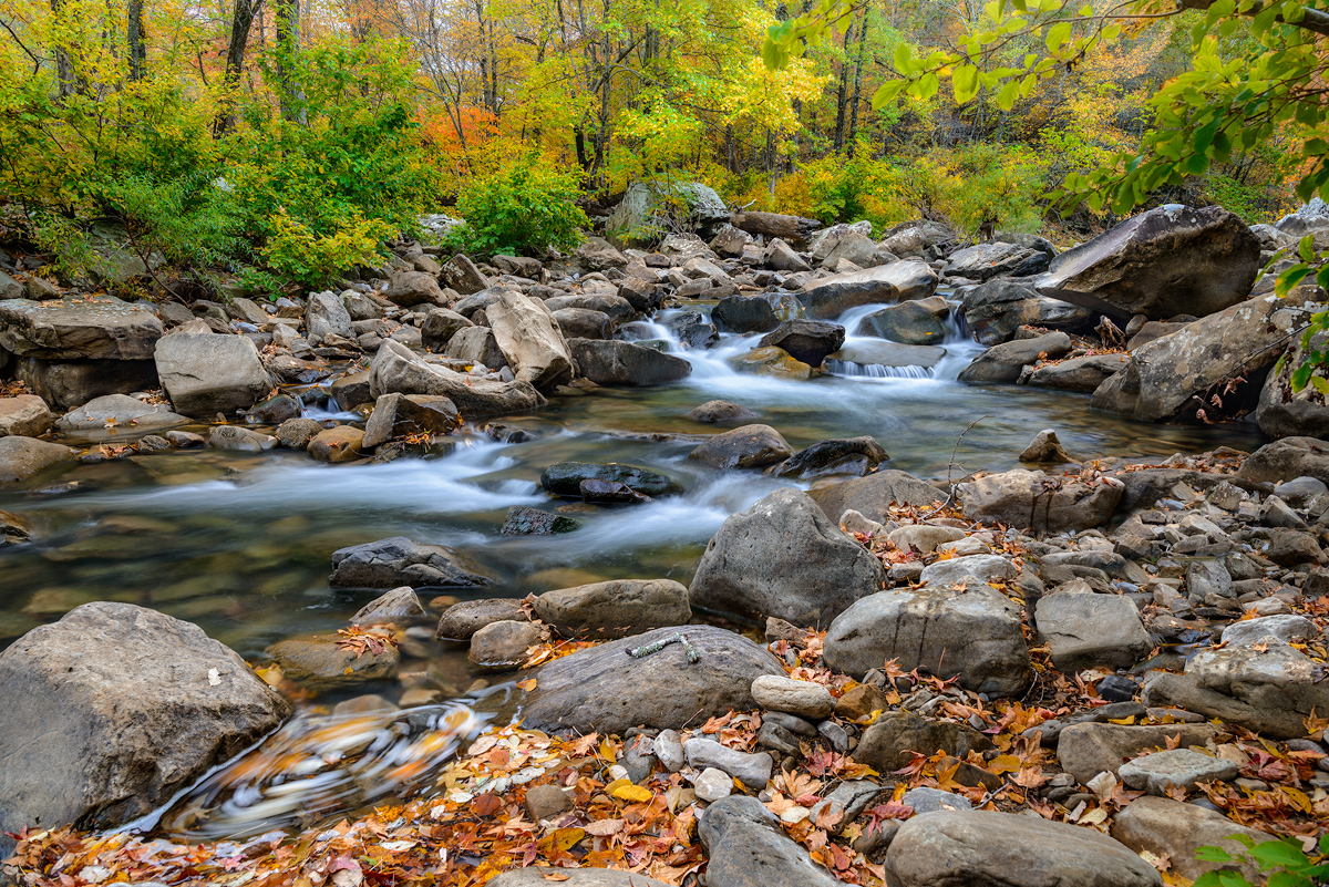
Some of the huge boulders along a small creek on White Oak Mountain

Some of the best spots for photography in Arkansas are working the smaller creeks up into their headwaters.  This tends to involve a lot of down hiking but the results can be well worth it.  White Oak Mountain, is actually a long ridge that runs east and west near Hector Arkansas.  To get there, you need to drive to Hector, through the town and as soon as cross a small bridge over a minor creek, you will see a dirt road heading up to the right.  Stay on this road for about 7 miles, there will be some turn offs but once you find the right spot, you can hike right down into a great creek valley.  This creek has a nice run which offers several nice smallish waterfalls in quick succession.  If you hike up the far hillside, you can find some much more dramatic waterfalls, but these will only be running after a locally heavy rain.

What I found most interesting on White Oak mountain was the number large boulders that were just laying in the creek.  This reminded me of Richland creek, however the terrain is a bit more open than on Richland.

Once you are done in the creek valley walking is very easy and you can make good headway.  There is a RV trail and a marked hiking trail that will take you down to the creek.  This creek outwardly appears to be about 1/5 the volume of Richland creek, but the unique geography surrounding the creek makes the hike worth a trip.  I would warn anyone that crossing this creek in high water could be a bit dangerous as the bottom is full of large mossy rocks easy to slip on.

I hope to make another trip here in the future to see what the area looks like in Spring with more water running.

To capture this photograph, I used a Phase One XF camera with a IQ260 Medium Format back and 55mm LS lens.  The photograph was taken with a nodal panorama setup and I used the captures to make the one horizontal shot.  To slow the water down I used ISO50 on my camera and a polarizer.  As you can see in the photograph, the light was already marching up the far side of the valley, so I did not need a ND filter.  The raw files were converted in Capture One software and then I used PtGui to stitch the 3 images together.  I then added a bit of Topaz clarity to my liking.


11/10/15 Springtime at Haw Creek Falls–A great place to spend a day in Arkansas

Haw Creek Falls, waterfalls in Arkansas

Springtime View of Haw Creek Falls in the Arkansas Ozarks

Taken with a Phase One IQ260 and Arca rm3di tech camera/40mm Rodenstock lens

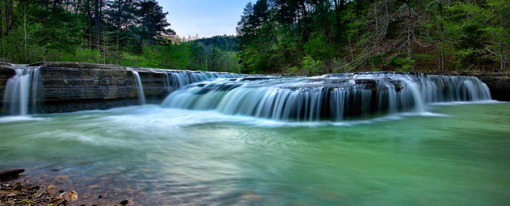
This is a typical day at Haw Creek falls, and I was again lucky to be there without anyone else to stand around and get in the way during the shoot.  Haw Creek is a lovely smallish creek that runs in the Big Piney Creek, not far from these falls.  The falls are impressive since there is a large ledge that runs all the way across the creek and in higher water conditions the water will start to consume the entire ledge.  I like to catch water about like this, just enough to keep most of the ledge in play but not too much to flood out the rocks below the falls.  To get this shot, I used my Arca rm3di camera which allows movements like a large format camera with my digital camera back.  The shot is actually a composite of 3 images, Left, Center and Right.  The Left and Right segments represent 16mm of shift in those respective directions.  This allows you to create a very high resolution panorama without any of the issues like parallax.  The lens I used was as 40mm Rodenstock HR-W which allows for an excellent field of view when shifted.

You have to be careful when working Haw Creek as there tends to be a lot of wind blowing down the creek.  In most cases, I prefer to take a 1 to 4 second exposure of the water which in most cases will have a lot of wind blur in the trees.  So you have make sure to cover the tree movement with a second series of exposures around 1/125 to 1/250 to stop the wind movement.  It’s a simple process to combine the files later since I am using a tech camera and the movements are very precise.  To allow the longer exposures I used both a Circular Polarizer and a Neutral Density filter.    The polarizer will help with glare on the water and rocks and adds about 1.5 stops of exposure to the shot.  As this was a bright day, I had to use a 1.2x ND filter.  When I was taking the faster exposures for the trees, I left the polarizer on, but took the ND filter off as I no longer needed the extra exposure compensation.

As I already mentioned, Haw Creek Falls, tends to be overrun with people during the peak times of the year.  The best day to go is a Monday as there will not be as many people at the campground and thus less traffic around the falls.  There are some great swimming spots above the falls in the large pool that is created by the ledge.  It’s a great place to head to when you know you have some water running in the creek.  Also the Ozark Highlands Trail runs right by Haw Creek falls, so if you are planning a hike on this part of the trail make sure to stop and take a look.

The falls run year round, but the best times to photograph them are in the early Spring and winter when water levels are more consistent.  In the summer and fall you can sometimes get lucky after a locally heavy rainstorm and catch the falls running.  The fall display here is wonderful if you can catch it at the right time.

12/14/14 A nice view taken from the Mt Magazine summit

Fall Vista from Mt Magazine

Fall Vista from Mt Magazine

Fall for 2014 in Arkansas was not too much to write home about.  Colors were way off in most places, production mainly showing up in a dull brown color.  I attribute most of this to the weather pattern we had.  Warm, and then cold, and warm, then freezing the trees just did not have much of a chance.  I was at this same spot this year and the colors were just not the same, much more muted.  Still it was a nice day to be out for sure.  Read more about how this shot was taken here:  Mt. Magazine fall vista taken with an Arca rm3di.

07/24/14 Rain and more rain brings up Arkansas’s Prime Creeks in July

Richland Creek Arkansas Ozarks

Springtime on Richland Creek in the Arkansas Ozarks

This is a view of Richland Creek in late May, taken in the 2007 time frame, but I wanted to use this photograph to show just what Richland Creek should look like now, in July!!.  Normally this time of year, the water levels in the Arkansas creeks is very low, to almost dry.  Richland will run a bit of water in the summer months, but not anywhere enough to make it worth a trip up the creek.  All that normally is available will the pools below each of the drops, like the one in this picture.

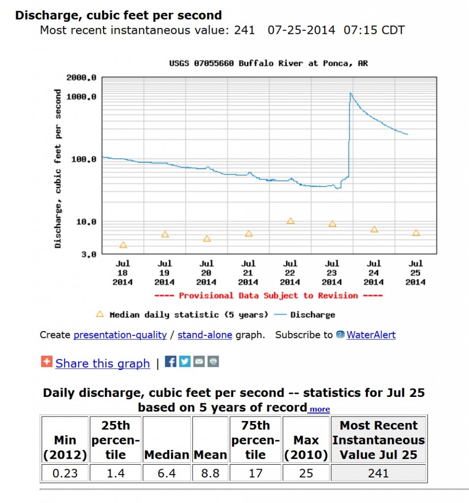
However in 2014, Arkansas has had a series of large rains, all of which hit the Ozarks.  Just 2 days ago, the Buffalo River, near Ponca was running at over 1000 CFS, which for the Buffalo in July is unheard of.  Richland was running in the 250 CFS range.

Water levels for the Buffalo River in Arkansas

USGS gauge levels for the Buffalo River in July 2014

As you can see in the graph above, the Buffalo was as high as 1000 CFS and is still in the 241 CFS range 2 days out from the rain.  This means that you could canoe the entire river from Highway 21 all the way to the mouth of the Buffalo where it runs into the White river.  But what is even more significant is look back 7 days and you can see that the Buffalo was holding in the 100 CFS range which is even more impressive.  Normally this time of year, you could expect to see around 15 CFS or less.  This is great news for the local canoe outfitters along the entire river as they can continue to rent boats into July.

Richland creek water levels in Arkansas Ozarks

Richland Creek water levels in July 2014

This graph shows the water levels for Richland Creek, which shows it did not hold to the 100 CFS range of the Buffalo but was still at 28 or so CFS before the last big rain.  Again, this is pretty impressive for a creek the size of Richland.

This means that if you like to hike the Arkansas Outdoors, July is a great time to get out.  Richland is not an easy hike in July as the undergrowth of the forest will make for a pretty hard hike.  There is no “official” trail up the creek, but if you get up there, work your way over to the left side of the creek, (when facing upstream) and you will find the age old trail that hikers have created from years of hiking up to Twin Falls or Richland Falls.  Your best bet right now is to start the hike from Richland Creek campground and after crossing Falling Water Creek, head up to the top of the adjacent ridge, where you can find the beginning of the trail that heads up Richland.


04/30/14 New Images added to my Arkansas Panorama Gallery

Haw Creek Falls Sunset Arkansas

Haw Creek Falls in Arkansas, taken at sunset.

I have recently added several new panoramas taken throughout Arkansas to my Panorama Gallery.  You can view the images here:

Over the years, I have started to shoot more panoramas than standard format photography as I feel it gives a better view of landscape subjects.  Many times I will shoot both ways, but after reviewing the images I will come back to the panorama images.  I have found three  ways to accomplish this:

1.  You can take the shot in a panorama format, which involves using special equipment to keep the foreground and background in focus.

2.  You can take one high resolution image and crop into it with a 3:1 ratio.  This requires a image of 50MP or more to allow for a large print.

3.  Setup your camera for a nodal pan.

With my current equipment I can work this either way since I can now use my Arca rm3di camera to allow for a stitching capture.   I can pick up as much as 18mm of new image details on each side of the center, and since I am stitching, not panning the camera, I will not have to worry about parallax issues.  Parallax comes about when you pan your camera/lens combination without consideration for the nodal point of that particular camera/lens.  What will occur most times with parallax errors is foreground and background elements of your subject will not line up.

With a digital back of 60MP it’s also possible to crop into a single image to a 3:1 ratio which is the standard for panoramas.  This most times will leave me around 25MP to work with and from that I can get a print sized to around 24″ x 60″ or 36″ x 72″.  Working this way is much faster as you don’t have to worry about merging the stitched images together.  During this process you can run into color balance issues or blurring, as the wind may have picked up during the stitching process and effected one of the 3 stitches.   This process allows you the greatest amount of freedom to compose as you can shoot with a tripod if the shutter speed allows it.

When time and conditions permit, I will try to work in a nodal pan also.  This is by far the most complicated of the three solutions as you have to have several factors taken into account:

1.  You will need a tripod that is level

2.  Your camera and lens need to set to the correct nodal point

3.  A panning head is usually required to help keep the panning lined up.

4.  Some form of stitching software will be needed to put the images together

5.  Most times even with a nodal solution, there will be issues while lining up the images

6.  Working with wide angles lenses is still complicated

The main reason I don’t prefer to use this setup is that you need to be level as if you pan with a non-level tripod, you will add all types of distortions to the final image.  Many times even if you have the camera/lens set to the correct nodal point, many of the images won’t come together correctly since I am mainly working with wide angle lenses.  This solution does allow for the highest amount of final resolution as you are using about 80% of the sensor on each shot the rest being lost to overlap.

Panoramas are very challenging, but can offer the photographer an excellent final image that can be printed in many more possible output solutions.


03/30/14 Mountain Lions in Arkansas–A follow up on my 1st report

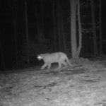
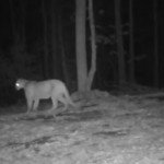
Mountain Lion near Boxley Valley

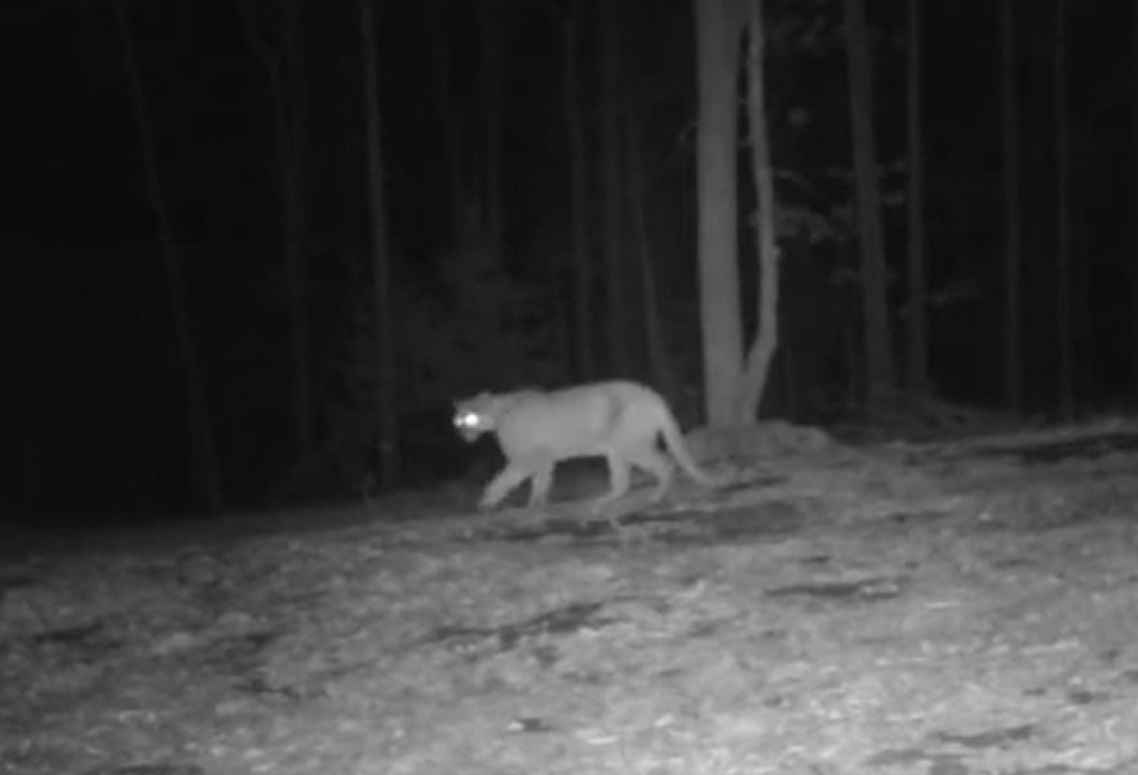
This is a still taken from a Game Camera of a Mountain Lion near Fallsville Arkansas

Recently I was sent a copy of this video from a game camera near Fallsville Arkansas by David Smith.  The series is about 11 seconds long total, but clearly shows an adult mountain lion.  If one has any doubt, just take the tree in the background for scale.  If you are familiar with the Arkansas woods as I am this is about a 18″ inch and then a smaller 5 or 6 inch tree branching out from the main trunk.  You can see the entire video here:

It’s most interesting to watch this series, as the cat is at first turned away from the camera, then must hear the camera activate.  The cat turns towards the sound of the camera and then moves off the frame right below the camera.  The motion of the mountain lion is very much like any other large cat and is most definitely not a fake or a small cat, bobcat or other creature.  Notice the loping motion as the cat approaches the frame.  It’s also interesting to watch the mountain lion’s head as it comes in closer and begins to look up towards the noise the camera must be making.

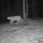
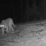
mountain lion and game camera

This is another shot of the large mountain lion coming towards the game camera

I have followed all of the comments I have received from my first post on Mountain Lions in Arkansas which have number over 120 total comments.  Taking out about 10% which were fictitious you are left with around 100 comments from people around Arkansas.  Most of these people are reporting sightings within the last 2 years, however some are commenting on sightings which would go back as far as 20 to 30 years ago.

Occasionally I will get a comment where a person is reporting the sighting of a “black panther”, or a mountain lion in a full black phase.  I have looked into the possibility of this.  However so far, worldwide, there have not been any captured, killed or sighted, North American cougars in a black phase.  The panther, which ranges in South America and Mexico, can have a black or dark phase.  You can read more about that here:   Panthers may also have ranged into the southern United States, but so far I have not heard of a panther being sighted in Arkansas.  However many people still claim that they are seeing “black panthers” in this state.  I am not sure what they are seeing.

This camera video for sure tells me that the North American Mountain Lion is alive and well in Arkansas.  The cat shown in this video seems a bit thin, however it’s also March and natural food supplies may not be as readily available.  The fact that his cat was sighted near Fallsville, is what give me a bit of of concern as Fallsville, is very close to the Glory Hole, the upper Buffalo River and several other popular outdoor recreation areas in Northwest Arkansas.

David Smith, the owner of the video, told me that he had sent a copy of this video to the Arkansas Game & Fish, and their only comments were that this was a “significant sighting”.  I believe since the Arkansas Game and Fish are now allowing bow hunters to purchase a mountain lion tag which allows the killing of a mountain lion, they are starting to take mountain lions in Arkansas a bit more seriously.  Hopefully with the number of sightings I have had reported, that many of these have also been reported to the Arkansas Game and Fish.  In the past the standard response has been, “this must be a cat that was released to the wild”, meaning it was not breeding naturally.  This cat looks to have done just that and has matured into an excellent example of the species.


01/04/14 It’s offical Sam’s Throne is now a full featured Forest Service Campground.

Sams Throne rock climbing campground

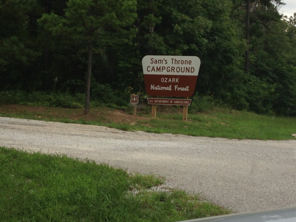
THE ENTRANCE TO SAM’S THRONE CAMPGROUND IN ARKANSAS

This actually happened in Mid 2013, but I never got around to writing about it.  They finally finished the improvements and created a formal campground status for Sam’s Throne.  This spot is a climbers paradise and for me a photographic wonder.  I work this area year round and love to work the bluffs of Sam’s after dark.  If you have not ever been here, it’s worth the trip up Hwy 7 to the Hwy 123 Junction.  Take Hwy 123 for about 10 miles north and then start looking for this sign.  You won’t find a bunch of RV steps here, and it’s a very informal campground, but it now has facilities and that’s a big improvement.  Sam’s Throne is one of the most famous climbing spots in Arkansas and is featured by a over 1 mile long bluff line made from primarily sandstone.  You can also look off the bluff to to the rock prominence that is the actual throne.   The road down to the bluffs has been dramatically improved since the early day’s when it was just a logging road.  Sam’s throne campground is pretty much on top of the bluff and you can get a great nighttime sky from there.  Once you get down to the bluff line looking northward you get a great shot of Red Rock and the valley of Big Creek.  Looking south towards the throne gives you a great view of the rolling hills moving off into the distance.

I have photographed Sam’s in pretty much all types of weather and as I mentioned above love to work it at night.  It’s not a bad compromise as you won’t be too far out from your car.  This area does get some rough folks driving by at times during the week, and I would not consider leaving a car alone at the trail head after dark unless there are some folks camping near by.  During the summer months and peak climbing season you can expect to have people there.  At the Bluff line you can walk along the top of the bluff in either direction and find great subject matter for your photography.

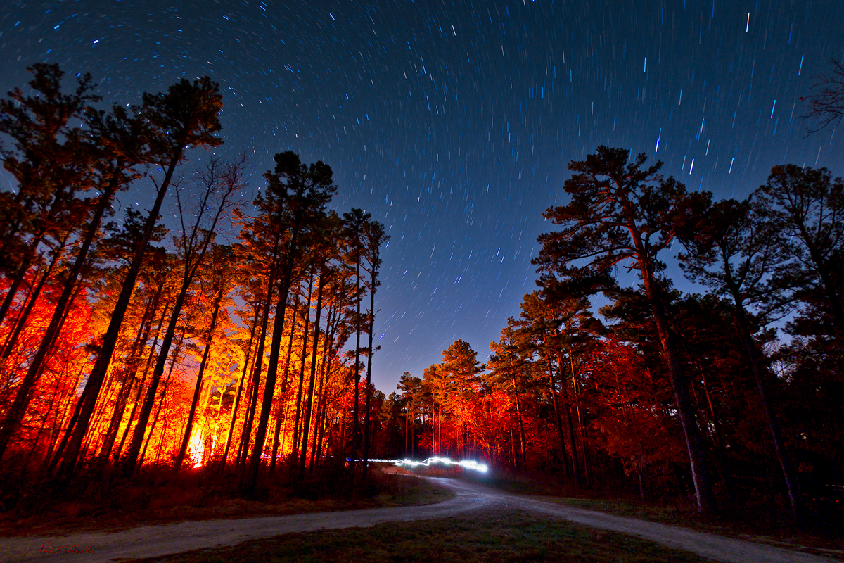
This shot is one taken during the night after the moon had set at the campground.  There was a group that had started a huge bonfire and the way it was lighting up the trees really caught my eye.  This shot was taken as single long exposure for about 30 minutes and during the time I had the shutter open a group of people walked by with head lamps on, and I really liked the effect they created.

Sam’s is a great spot to take the family and spend the entire day, be aware that there are sharp drop offs everywhere so if you are taking young children be careful.

Star trails over Sam's Throne in Arkansas

Star trails over Sam’s Throne in Arkansas

11/20/13 Notes on Sylamore Creek and Gunner Pool

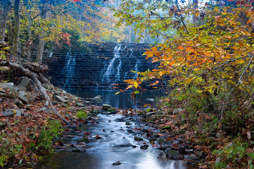
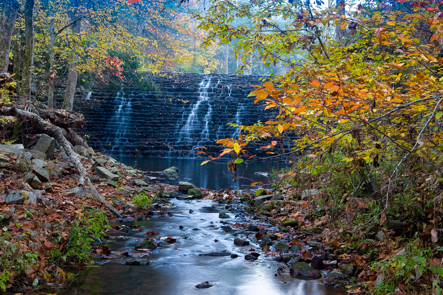
Fall view of Gunner Pool CCC dam at Gunner Pool Campground

Fall view of Gunner Pool CCC dam at Gunner Pool Campground

One of my favorite spots to spend time with a camera is around Gunner Pool campground.  There are some great old growth trees around this area and in the fall they tend to have a wonderful fall display.  Two of my favorite spots to work are from the old CCC (Civilian Convervation Corps) concrete bridge over Sylamore creek and then the old rock dam (featured in the photo) that creates Gunner Pool itself.  Around the old bridge there are some Sycamore trees that are over 70 feet tall and probably over 100 years old.  They can create a beautiful display in the fall.  Around the rock dam you will find hickory and maple trees most of which are 2nd growth forest and not very tall, but still they can create a wonderful display of color.

Sylamore creek also has some very nice spots to work with.  The lower level of the campground features about 5 separate campsites all of which are close to the creek.  The creek opens into a large pool.  For years I always thought that this was “Gunner Pool”, but the actual Gunner pool is made by the small side creek with the rock dam.  However the pool at Sylamore creek is a wonderful swimming hole and in the summer you can count on a large crowd to be there.  I prefer to go in the late spring and late fall when there are less people milling around.  The far side of the pool has some large rocks that have fallen off the tall bluff on the far side of the creek.  The campground side of the creek has a nice beach.  Further downstream you can find some nice rapids.

There is a trail that runs along Sylamore creek from Gunner Pool campground all the way to Barkshed campground.  This trail starts down by the creek as soon as you cross the high concrete bridge and then slowly works its way up to the top of the ridge.  It will pretty much stay up on the top of the ridge until you start to get close to Barkshed campground.  Barkshed is not a very large spot and does not have the same ambiance that Gunner Pool has.  The sites are much more primitive.

From Gunner Pool, you can hike on this same trail until you come to Blanchard Springs campground.  Here you can also spend sometime in the caverns which can be a nice experience especially in the summer.  There is a much more formal campground at Blanchard Springs with RV hookups and it’s definitely not a primitive campground.

If you are looking for a great place to explore and spend the weekend, then consider heading to Gunner Pool campground.


06/15/13 Gunner Pool Campground and 5 others closed to swimming due to e-coli outbreak

Fall view of Gunner Pool CCC dam at Gunner Pool Campground

Fall view of Gunner Pool CCC dam at Gunner Pool Campground

After reading the Arkansas Gazette yesterday, I noticed that several noted Arkansas swimming areas were closed due to a outbreak of e-coli in the water.  One of the areas mentioned was one of my favorite spots in Arkansas, Gunner Pool.  Sad to here this, and surprised to hear it due to the recent spell of high water we have had in Arkansas.  However Gunner Pool does tend to get a lot of use and the road will allow larger RV’s to make it into the campground.

This picture is of the CCC dam that creates the actual Gunner Pool, which is off to the far side of the campground and missed by many people who think the large pool in Sylamore creek is Gunner Pool.  This rock dam was made with local stone and created in the 1930’s by the CCC.  There was a formal CCC camp at Gunner Pool for many years.  I took this photograph of the dam back in 2008 after a rain storm.  The fall colors were just starting to peak.

Gunner Pool Campground and Barkshed Campground swimming areas were both closed along with the larger swimming area at Blanchard  Springs.  This implies that the problem is in Sylamore Creek itself and may be from some farm effluence running off into the creek.  These types of breakouts tend to occur later in the summer after the water has started to stagnate.  However Arkansas just had record streamflows less than two weeks ago and I am sure that Sylamore creek was effected.

Hopefully this ban won’t be for the rest of the year, but with all of the layoff and cutbacks in the federal programs, it’s hard to tell what’s going on anymore.  Just recently a large number of campgrounds along the Buffalo river had their facilities reopened since locals volunteered to keep them clean.  Gunner Pool is a full service campground with facilities, Barkshed is more of a primative site with tents sites only.  Both are bordered by Sylamore creek.

Sylamore creek is a great spot to visit in cleaner times.  It’s one of the best small creeks in the Arkansas for day hiking and if you hike up the creek from Gunner Pool you will be treated to several nice small bluffs and rapids that make for great photographic subjects.  There is also a formal backpacking trail that runs from Gunner Pool to Barkshed.  This same trail also runs all the way to Blanchard Springs caverns.

06/13/13 Review of recent highwater levels in Arkansas Ozark and Ouachita streams

Bills Thrill rapid on Richland Creek in low water

Bills Thrill rapid on Richland Creek in low water

In Arkansas, there are times of drought and times of heavy rains which create high  flows in Ozark and Ouachita mountain streams.  In a normal year, most of this high water will happen in mid to late March and most of April, and starts to wind down by mid May.  Usually by June stream flows in all but the largest trunk streams will be down to a very small flow.   However this year, all of that logic was thrown out the door as Arkansas had quite a late spring with freezing temperatures still happening into late April.  As May rolled in strong storms developed several times during the month, however by the heaviest amount of rainfall came in a period over 2 days, 05/30/13 and 06/01/13.

The heaviest amount of rain fell in the southwest part of the state, and this brought up all the main streams.  There was locally heavy flooding and some fatalities occurred during the flooding.  I tend to gauge the stream flow in Arkansas by reviewing the levels of what I determine are critical trunk streams:

  1. The Cossatot River in the southwestern corner of the state
  2. The upper end of the Buffalo National River near Ponca Arkansas
  3. Richland Creek in the center of the Richland Wilderness

I use the USGS gauges, which are online at this location.  You can get an excellent feeling for how much rain has fallen by looking at the stream flow increases.  If you look at the series of images from the gauge on the Cossatot, you can see that the stream rose to around 30,000 CFS (Cubic Feet per Second of flow) in around 2 hours.  This is classic flash flooding and is a very dangerous time to be out driving around on local road.  What’s also telling is just how fast the Cossatot fell back to a “normal” level.  By looking at the charts, you can see that really before daylight, the Cossatot had already dropped back down to a much lower level.  What is even more interesting, is that in the 2nd heavy rainfall on the night of 06/01/13, the Cossatot rose back up to close to 20,000 CFS again in less that 2 hours.

The first graph shows the two peak levels, of 30K and 20K in a total overall time frame of less than 24 hours.  The 2nd graph shows the final peak reading on 06/01/13 where the river recorded over 20K CFS. I have seen a video taken by Max Wellhouse way back in the late 1990’s of the Cossatot at 10,000 CFS, so I can only imagine it at 30,000.  The 6 falls of the Cossatot would be a site to behold if you could even get down to shoot around them.  I am assuming that the water would be pretty maxed out in the narrow canyon that is created around the 6 falls and any viewing would have to be done from above the level of the falls on the surrounding bluffs.  So what about the northwestern part of Arkansas, well not quite as much rain fell, but Richland creek most definitely saw the same double peaking like the Cossatot.

Anyone who know me or my work, knows I am a bit partial to Richland Creek.  Hands down it provides some of the best photographic studies in Arkansas.  This is true in winter, spring, summer and if you are lucky fall.   Catching Richland with a good flow in the fall is very prone to luck.  Richland is enjoyed by a huge cross section of recreation seekers in Arkansas and other local states.  This includes:

  1. Kayakers
  2. Hikers/Backpackers
  3. Photographers
  4. Hunters
  5. Fishermen

There is a great primitive campground about 1/2 way of Richland’s length where forest road 1205 crosses the creek.  Since 1974 I have hiking, photographing, or kayaking on Richland and know it very well.  By gauging Richland creek you can get a great feel for how high the smaller tighter streams are running, like Falling Water Creek, Bobtail Creek, Big Devils and Long Devils creeks.  All of these smaller creeks have individual features that make them appealing.  On the 30th of May, Richland rose up from around 150 CFS to over 9000 CFS in less than 3 hours.  This much water on Richland is easily what I would call a flash flood, and would most definitely cover the bridge at FS 1205.  This amount of water may also start to flood into the lower level of the campground. What also has to be remembered is that at the campground, Falling Water Creek also comes into Richland.  Falling Water Creek would be the largest tributary to Richland, with Bobtail creek being the 2nd.  If there was 9000 CFS at the Richland gauge, easily 1/3 of it was coming in from Falling Water Creek.   In the images below you can see just how fast Richland rose up.

[Read more…]

06/11/13 The Cut on Forest Road 1205 in Searcy and Newton Counties of Arkansas

The cut along Forest Road 1205 in Newton County, Arkansas

The cut along Forest Road 1205 in Newton County, Arkansas

Image was taken with a Sony Nex-7, Sony 16-80mm Zoom Zeiss lens @ 16mm (effective 24mm on Nex7), iso 200.  This is a composite image taken in 3 vertical segments then stitched together in Photoshop CS6 to get the final image.  Raw files were converted using Lightroom 4.1

If you have traveled the back roads of Arkansas much, you will have driven on forest road 1205.  This single road passes some of the most impressive scenery in the state.  1205 runs pretty much north and south and for about half of it’s length it parallels Falling Water Creek.  Falling Water Creek has some very impressive features including Falling Water Falls, which is a ledge drop that covers the entire width of the creek and is about 13 feet high.  1205 follows along Falling Water Creek, and then crosses over Richland creek, which is one of the best places to hike, camp and photograph in Arkansas.  From the crossing of Richland, 1205 begins a long climb up the adjoining ridges and then tops out about 1000 feet higher at Dicky Junction.  1205 can be driven in a car, but there are places where it might be a bit tough as the road has started to really fall apart here it enters Newton County.   There are many people who live along 1205 and it’s a road that is important as a U.S. mail connection.

Many people won’t remember back to March of 2008, but during this time in Arkansas there were several really heavy rains that fell in close succession to each other.  The first one of these rains started a minor slide in a weak hillside along 1205.  This spot was about 2 miles south from the Richland Creek Campground.  The slide was minor and with some bulldozer work most of it was cleared up.  In the next few weeks, more heavy rainfall caused a further weakening and eventually the entire mountainside slumped away.  The damage was tremendous and for about 1/16th of a mile where 1205 had been was only a mass jumble of downed trees and huge rocks.  Several times I attempted to hike through to the other side, but the damage was such that you really could not make much progress before coming to a huge tree or rock which required a long detour.

The plan was to have the U.S. Forest service repair the road and do a repair that would last.  In the interim, Richland Creek campground was closed and one of the most vital links for transportation was no longer there.  For about the next 2 years, not too much was done.  Many people complained about the campground being closed, but the Forest Service felt that they could not get access to this area fast enough if there was an emergency.   Traffic was routed back around the upper end of 1205 if you wanted to get to Richland.

[Read more…]